Attitudes and Altitude: Destination Guide to the Grande Traversata delle Alpi
Inspiration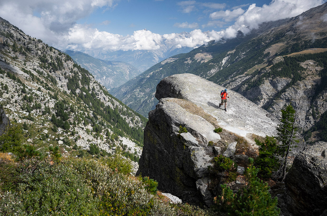
Written by Alex Roddie // Photography by James Roddie & Alex Roddie
A guide to fastpacking the Grande Traversata delle Alpi (GTA) – Italy’s answer to the GR5.
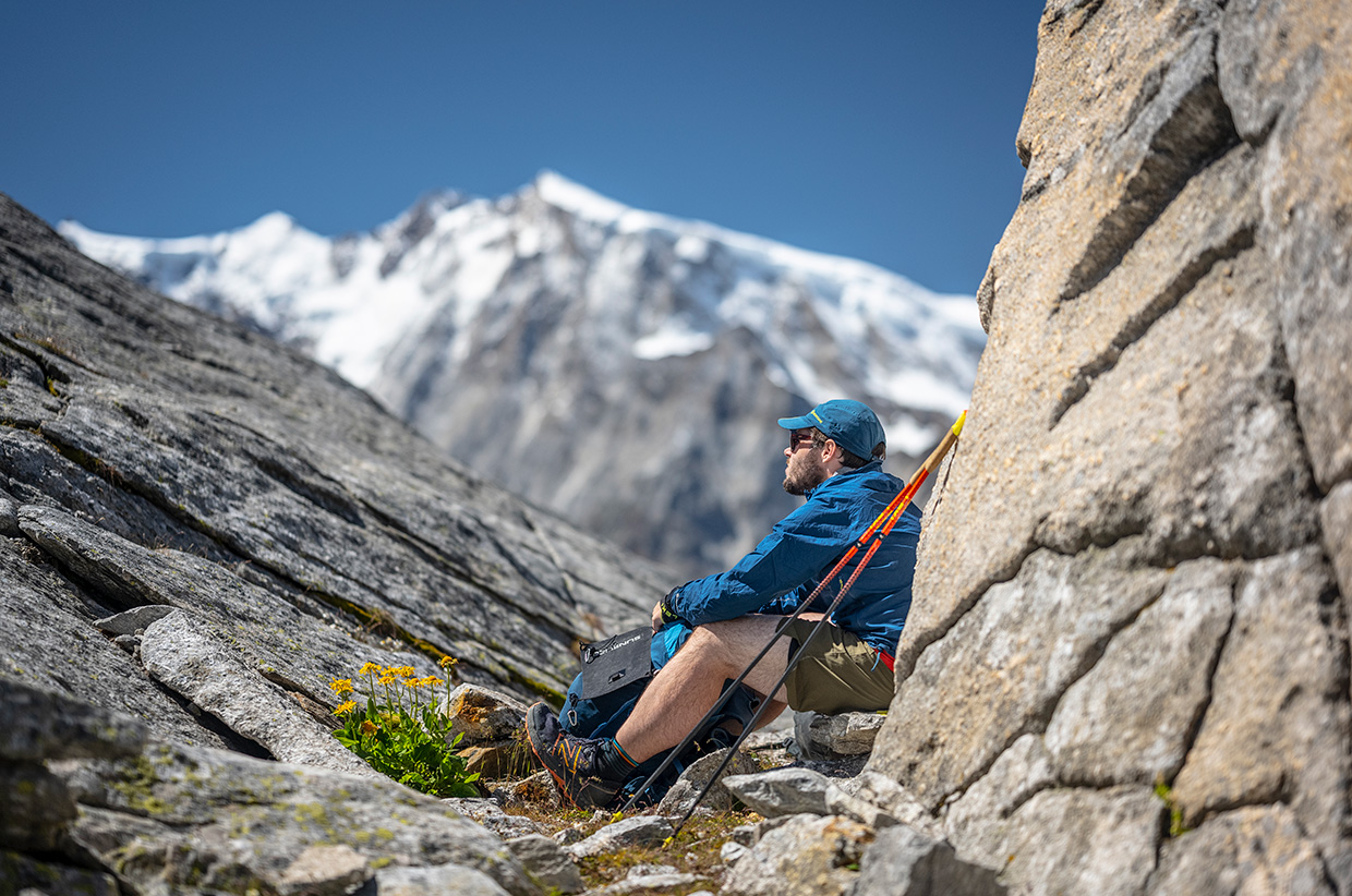
In summer 2022, our editor Alex Roddie set out on a fastpacking trip across the Alps: 900km from Ventimiglia to Zermatt, featuring countless mountain passes. This is part of a series of online stories about his project, helping you to go higher and faster in the mountains.
THE FULL SERIES
Attitudes and Altitude: Mountains of the Mind Feature Story
Attitudes and Altitude: Tranter’s RoundAttitudes and Altitude: Destination Guide to the Grande Traversata delle Alpi
Attitudes and Altitude: How to Go Fastpacking
Attitudes and Altitude: Gear Guide for Alpine Fastpacking
Attitudes and Altitude: Gear Review
Although some parts of the Italian Alps are popular with mountaineers, hikers, and trail runners, overall it is nowhere near as busy as the French side. Beyond a few honeypots you are almost guaranteed quiet trails, even in high summer. There is less development, too, and some regions still feel spectacularly wild. But the landscape is just as impressive. These are all good reasons to consider the Italian Alps as a destination for fastpacking and long-distance hiking.
The Grande Traversata delle Alpi (GTA) is Italy’s counterpart to the GR5, mirroring the famous French trail’s north-south axis on the other side of the range. Although nowhere near as well known as the major classics such as the Walker’s Haute Route or Tour du Mont Blanc, the GTA rivals them all in terms of quality, and takes you through mountain ranges that often feel utterly different. The GTA’s relative obscurity is something of a puzzle, because the route has all the makings of a classic: a line following the curve of the Alpine chain from Ventimiglia on the shores of the Mediterranean to the Swiss-Italian border at the Gries Pass – traversing the Ligurian, Maritime, Cottian, and Graian Alps, a corner of the Pennine Alps, and finally the Lepontine Alps.
Like any linear trail, the GTA can be followed in either direction. It is officially described as a southbound route beginning at Gries Pass. However, when planning my Attitudes and Altitude fastpacking trip in summer 2022, I decided to go northbound – and modify the route in order to take in some favourite Swiss trails, finishing at Zermatt. I stuck to the line of the GTA as far as Ceresole Reale (520km from the start).
General info
– Distance: 842km (my route: 900km)
– Duration: 50–60 days (hiking) or 20–40 days (fastpacking)
– Total elevation gain: 54,436m (my route: 60,102m)
– More info: gta-trek.eu
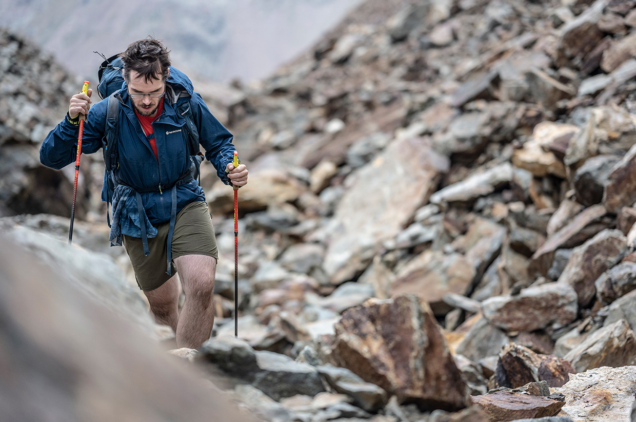
The GTA cuts across the grain of the land, crossing from one high ridge and across a valley to the next. This results in a lot of elevation gain and loss. Whether you’re hiking or running, it’s a lung-buster of a route – and even taking short days, it’s difficult to avoid one or two passes and at least 1,000m of ascent every single day. Fit hikers looking to achieve a more typical 25–30km per day will average at least double that, or even more if you’re looking to complete it as a fastpacking route with bigger days. Most of the passes are short and steep with minimal time to recover before the next one.
Despite its strenuous nature, the trail is not technical. Most of the paths are relatively easy – especially in areas where you’re close to the border, as these regions are networked by old military tracks once used to service fortifications. These trails climb in well-graded switchbacks through shady larch woodlands and are easy both in ascent and descent. In other areas, trails are variable – sometimes rocky and scrambly, but never requiring specialist mountaineering gear.
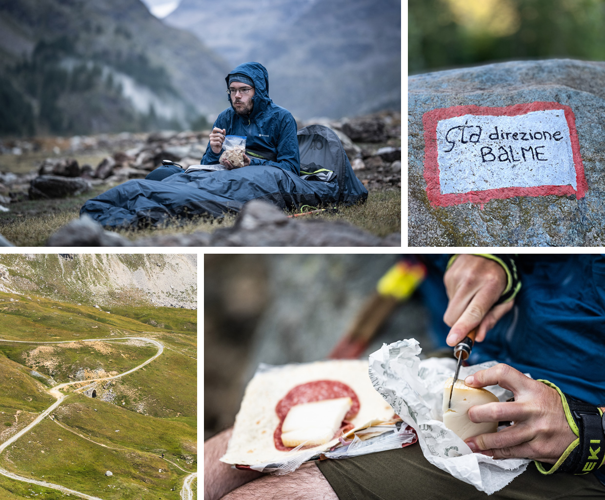
The trail is not 100 per cent waymarked. Some sections are clearly marked with GTA trail signage, while others have only local signage (for example, the Alta Via dei Monti Liguri at the southern extremity). Quieter stages are often unmarked and extremely vague or overgrown on the ground, requiring careful navigation. This is part of the route’s charm: it does not handhold you on every tricky bit.
Accommodation
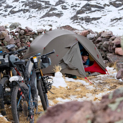
I found that Alpine huts (rifugi) could only be reliably found on the more popular sections of the GTA. On the more obscure legs, such as the Ligurian Alps, huts tended to be locked up, or even ruined, making camping or village accommodation a must. You will find many guesthouses and bunkhouses (posti tappa) along sections of the trail, usually in or near villages. You’ll also come across the occasional valley campsite, but these are few and far between, and not particularly hiker friendly. Most cater largely for caravans and have only small areas available for tents. Some don’t have laundry facilities.
Although wild camping or bivvying is not technically allowed in Italy, in practice almost everyone does it. None of the local people I spoke to minded, and in fact I was often given directions to the best places to camp! As always, leave no trace that you were there.
Supplies
It’s easier to pick up supplies on the trail’s northern half, where villages and refuges are more frequent. For most of my journey I didn’t need to carry food for more than two or three days at a time (often much less). However, the landscape is much wilder in the southernmost 200–300km, and there are fewer villages, especially in the Ligurian Alps. Here you will need to plan your resupplies more carefully.
If staying in refuges, you’ll get all the food you can eat – and even if you aren’t staying, it’s usually possible to eat there if you arrive on time (outside mealtimes, you can buy snacks and beer). I found that even the tiniest villages often had a restaurant, usually run as a family operation and serving a limited menu of good, cheap food. Village shops vary from tiny one-room stores selling traditional staples to fully modern supermarkets, but most are small and have a limited range. You will only find specialist items such as dehydrated meals in one or two places.
Don’t forget the Italian siesta. Most small stores close for two or three hours in early afternoon, typically just when you arrive in town and want to refuel before cracking on up the next pass…
Highlights
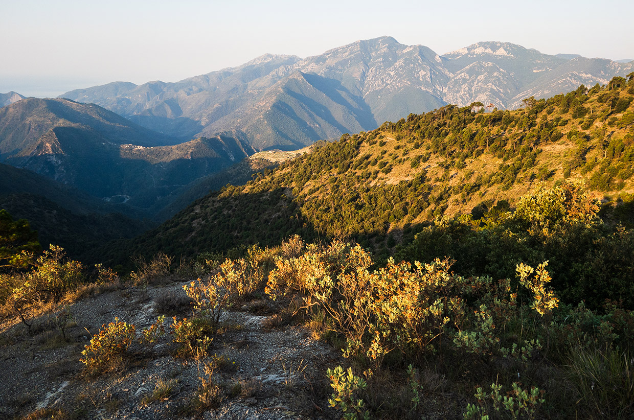
1. Ligurian Alps
My first few days after leaving Ventimiglia were hard, but also very beautiful. This range of low foothills climbs up from the Med into an arid, sparse landscape of scrub and pine forest, alive with the music of cicadas. I saw no other hikers or runners for three days – and no natural water sources for 70km. Every well and fountain marked on the map was dry (the sad result of a multi-year drought) but I managed to find enough water in two small, stagnant sources (filtration essential) to see me through to my first flowing stream. It’s also one of the few sections of the GTA where the trail gets up high onto a ridge and stays there, and I enjoyed some wonderful runs along easy trails with views of bigger peaks in the distance.
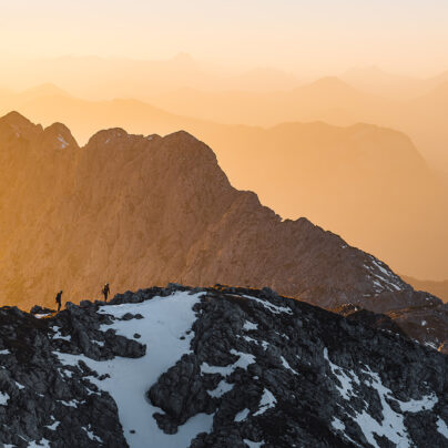
2. Cuneo Dolomites
This is the informal name given to the mountains around Monte Oserot in the Rother guidebook to the trail (Iris Kürschner and Dieter Haas). These peaks were the first to make me say ‘Wow, these are big mountains!’ Limestone summits rise as dramatic white towers above cunningly constructed military trails, which often cut directly across steep slopes in unlikely locations. There’s more than a passing resemblance to the true Dolomites away to the east. The views on this section are some of the best on the entire GTA – and there are also mysterious military ruins to explore, including several abandoned forts.
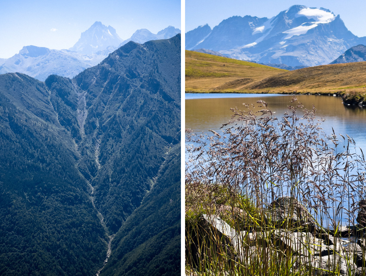
3. Monviso
Monviso, the legendary King of Stone and the most prominent peak of the Cottian Alps, stands as a major waypoint along the GTA. It first becomes visible a long distance before you get to it, and you can see it for days afterwards, rather like the Lonely Mountain from The Hobbit (although sans dragon). It had a personal significance for me in that it marked a third of my total distance to Zermatt. The trail encircling Monviso is truly exquisite: shrouded in wild pine forests at lower elevations, and higher up there is a vast wilderness of shattered rock, giving this stage a high-mountain ambience. It’s a popular trail, and the Rifugio Quintino Sella is a superb hut – it serves particularly fine polenta.
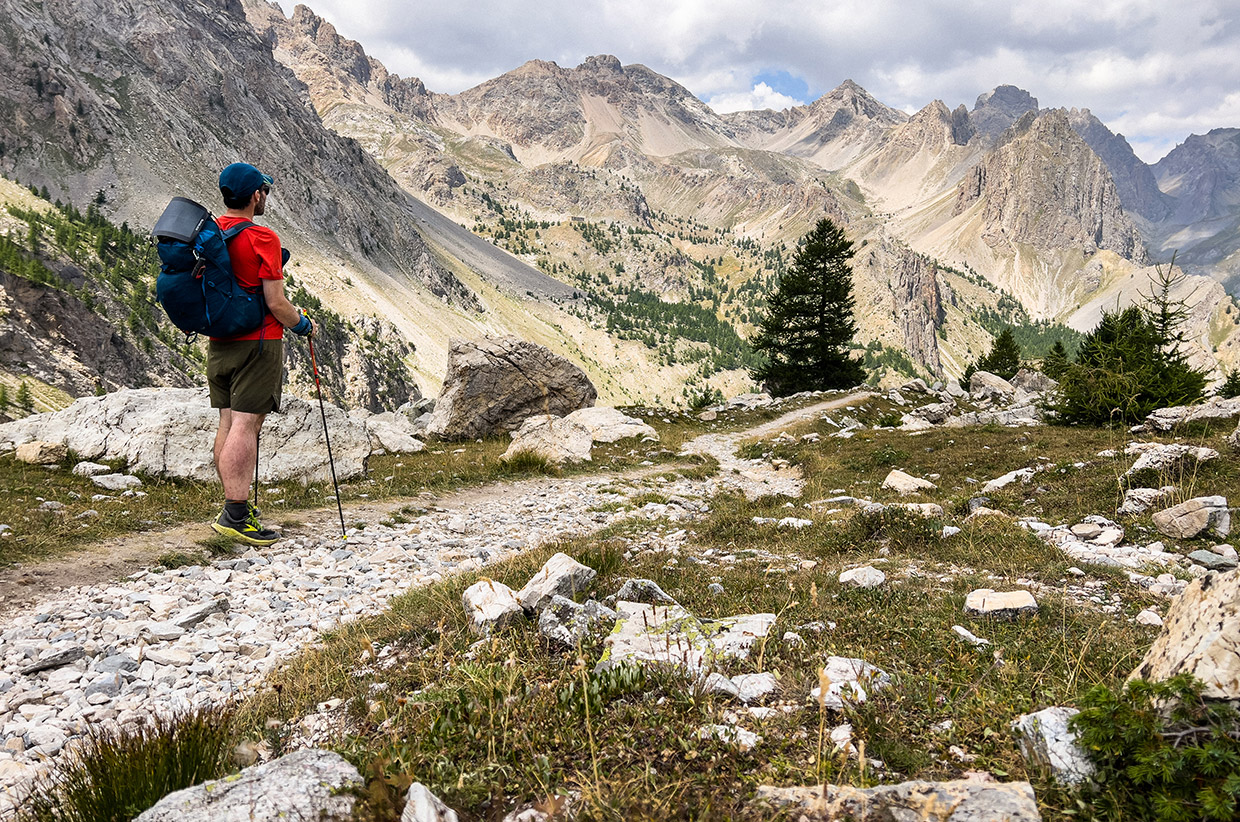
4. Gran Paradiso
Gran Paradiso is the first 4,000m Alpine peak you’ll see at close hand. It looms as an impenetrable mountain wall on the northern horizon, and is especially impressive viewed from Colle della Crocetta just before the descent to Ceresole Reale. The mountain is a paradise not only for mountaineers but also trail runners and gravel bikers. It was here that my route diverged from the GTA: I headed west, while the GTA continued east. The wildlife is particularly rich in this area. Look out for spotted nutcrackers in the pine forests.
4. The Swiss extension
I entered Switzerland at the Col du Grand Saint-Bernard after two days exploring the Aosta Valley. My route combined sections of the Walker’s Haute Route, Tour of the Matterhorn, and Tour of Monte Rosa. Trails tend to be busier and better marked than in Italy, but also more spectacular – for the first time I found myself travelling close to large glaciers (even traversing an easy one). Highlights of this stage include the receding Grand Désert glacier beneath Rosablanche, the exposed Pas de Chèvres before descending to Arolla, the Monte Moro Pass, and the beautiful forested Balfrin Höhenweg.
Alex Roddie ran and hiked 900km from Ventimiglia to Zermatt via the Grande Traversata delle Alpi, Tour of the Matterhorn, and Tour of Monte Rosa – a journey involving 60,102m of ascent. A version of this story was first published in Sidetracked Volume 25.
The Attitudes and Altitude project was supported by Montane and LEKI
Written by Alex Roddie // @alex_roddie
Photography by James Roddie // @james_roddie_photography