

SENTIERI ARQUATA DEL TRONTO
ITINERARIES, TRADITIONS & LOCAL FOOD FOR THE RENAISSANCE OF THE TERRITORY
CommunityBook – Le Tartarughine Sentieri
Credits
CommunityBook – Le Tartarughine Sentieri
The paths of Arquata del Tronto
Edition: October 2022
An idea by: Luigi Carletti - Edoardo Fedele
Project by: Typimedia publisher
Edited by: Antonio Tiso
Photos: Andrea Vagnoni
Layout: Natascia Gnagnarella
General organisation and quality control: Serena Campioni
Editorial work: Carolina Tocci and Costanza Giannelli
Product manager: Raffaella Mazzon
Communication and Social Marketing: Chiara Gelato
Cover: Photo by Andrea Vagnoni
ISBN: 978-88-3626-173-4
ISSN: 2785-763X
Online CommunityBook: www.typimediaeditore.it
Editor-in-chief: Luigi Carletti
Photo credits: Pierluigi Giorgi pp. 12-13
The publisher is willing to pay fair compensation for any use of images for which the right holders could not be found.
With the free patronage of the Municipality of Arquata del Tronto Arquata Potest Association collaborated in the editorial realisation of this volume

this guide has been realised thanks to the contribution of AVIS Provinciale of Ascoli Piceno and BIM Tronto of Ascoli Piceno
© COPYRIGHT
All the contents of CommunityBook and of the other editorial products of the Typimedia company mentioned in them are the exclusive and reserved property of Typimedia itself and are protected by current national and international regulations on the protection of intellectual and/or industrial property rights.
They may not be reproduced or used in any way and/or by any means, in whole or in part, without the prior consent of Typimedia. or in part, without the prior written permission of Typimedia. Any abuse will be prosecuted in accordance with the laws in force, with a claim for damages.
For information or requests: info@typimedia.it
COMMUNITYBOOK - Le Tartarughine Sentieri
newspaper registered with the court of Rome under number 162/2019 of 5 December 2019

THE PATHS OF ARQUATA
October 2022
Editor-in-chief: Luigi Carletti
Publisher: Typimedia srl -Viale Regina Margherita, 279 - 00198 Roma (RM)


ARQUATA DEL TRONTO
ITINERARIES, TRADITIONS & LOCAL FOOD FOR THE RENAISSANCE OF THE TERRITORY
ARQUATA DEL TRONTO
ITINERARIES, TRADITIONS & LOCAL FOOD FOR THE RENAISSANCE OF THE TERRITORY
THE G.A.D.A. IN 4 STAGES
1. From Pretare to Spelonga

2. From Spelonga to Colle d’Arquata
3. From Colle d’Arquata to Pescara del Tronto
4. From Pescara del Tronto to Pretare
THE RINGS OF THE ARQUATA DEL TRONTO’S FRACTION
5. The ring of Trisungo
6. The ring of Pretare
7. The ring of Piedilama
8. The ring of Spelonga
9. The ring of Camartina - Forca di Presta
10. The ring of Colle d’Arquata
11. The ring of Borgo d’Arquata
12. Accumoli - Pantani - Capodacqua ring
MEDIUM - HIGH MOUNTAIN PATHS
13. From Forca di Presta to Rifugio Belvedere
14. From Forca Canapine to Pantani Di Accumoli
15. From Casale Mezzi Litri to Picchio7
16. From Forca di Presta to Forca Canapine
17. From Forca di Presta to the Galluccio mountain pass
18. From Colle d’Arquata to Pizzo di Sevo
19. From Forca di Presta to monte Vettore
G.A.D.A. - BIKE
20. The G.A.D.A.-Bike
21. Ring of Forche
22. Ring at the foot of the giant
23. La Laga bypass
24. Castelluccio ridges ring

THE MAP PRETARE PIEDILAMA SPELONGA TRISUNGO PESCARA DEL TRONTO ARQUATA DEL TRONTO FORCA DI PRESTA COLLE D’ARQUATA 3 4 1 2 19 17 16 15 14 13 18 5 6 7 8 9 10 12 20 23 11 BORGO 22 21 24
INDEX
MAP ............................................................................................................................... ..................... 4 A GUIDE FOR REFLECTING AND RECONSTRUCTING 9 SERVING THE TERRITORY .................................................................................................................... 11 THE OUTDOOR TO REVITALISE THE TERRITORY .................................................................................... 15 WHAT DOES IT MEAN TO “RESTORE A PATH”? ....................................................................................... 17 ARQUATA OVER THE CENTURIES .......................................................................................................... 18 THE G.A.D.A. IN 4 STAGES ............................................................................................................... 21 1. FROM PRETARE TO SPELONGA ......................................................................................................... 22 2. FROM SPELONGA TO COLLE D’ARQUATA .......................................................................................... 26 3. FROM COLLE D’ARQUATA TO PESCARA DEL TRONTO ......................................................................... 30 4. FROM PESCARA DEL TRONTO TO PRETARE ...................................................................................... 34 THE TERRITORY ............................................................................................................................... .. 38 THE RINGS OF THE ARQUATA DEL TRONTO’S FRACTION .................................................................... 41 5. THE RING OF TRISUNGO ................................................................................................................. 42 6. T HE RING OF PRETARE 46 7. THE RING OF PIEDILAMA ................................................................................................................ 50 8. THE RING OF SPELONGA 54 9. THE RING OF CAMARTINA - FORCA DI PRESTA ................................................................................. 58 10. THE RING OF COLLE D’ARQUATA 62 11. THE RING OF BORGO D’ARQUATA ..................................................................................................... 66 12. ACCUMOLI - PANTANI- CAPODACQUA RING 70 AN HERITAGE TO BE RESTORED .......................................................................................................... 74 MEDIUM - HIGH MOUNTAIN PATHS .................................................................................................... 77 13. FROM FORCA DI PRESTA TO THE BELVEDERE REFUGE .................................................................... 78 14. FROM FORCA CANAPINE TO THE ACCUMOLI PONDS ........................................................................ 82 15. FROM THE MEZZI LITRI REFUGE TO PICCHIO7 ................................................................................. 86 16. FROM FORCA DI PRESTA TO FORCA CANAPINE ............................................................................... 90 17. FROM FORCA DI PRESTA TO THE GALLUCCIO MOUNTAIN PASS ......................................................... 94 18. FROM COLLE D’ARQUATA TO PIZZO DI SEVO .................................................................................... 98 19. FROM FORCA DI PRESTA TO MOUNT VETTORE ................................................................................ 102 MYTHS AND LEGENDS ....................................................................................................................... 106 G.A.D.A. - BIKE .............................................................................................................................. 109 20. THE G.A.D.A.-BIKE ...................................................................................................................... 110 21. RING OF THE FORCHE 114 22. RING AT THE FOOT OF THE GIANT ................................................................................................ 118 23. THE LAGA BYPASS 122 24. CASTELLUCCIO RIDGES RING ....................................................................................................... 126
TIPICAL DISHES ............................................................................................................................ 131 1. OMELETTE WITH MINT 132 2. THE “CORATELLA”: LAMB OFFAL ARQUATAN STYLE ......................................................................... 133 3. THE FAIRY SOUP (ZUPPA DELLE FATE) ........................................................................................... 134 4. POLENTA CARBONARA - STYLE ..................................................................................................... 135 5. TIMBALLO DI CRESPELLE .............................................................................................................. 136 6. LEPANTO - STYLE MEZZE MANICHE ................................................................................................ 137 7. I LUNGHETTI: “THE LENGHTIES” ..................................................................................................... 138 8. THE CAZZIMPERO .......................................................................................................................... 139 9. THE ‘NGRECCIATA ......................................................................................................................... 140 10. “TRE-SEI-NOVE”: THREE-SIX-NINE ................................................................................................ 141 11. NOCIATA ............................................................................................................................... ....... 142 12. CHESTNUT RAVIOLI ...................................................................................................................... 143 LOCAL BUSINESSES ....................................................................................................................... 145 1. LE TERRE DELLE FATE (THE FAIRY LANDS) ..................................................................................... 146 2. PETRUCCI BUTCHER SHOP 147 3. OSTERIA DEL CASTELLO (THE CASTLE TAVERN) ............................................................................. 148 4. ANTONIO FILOTEI BUTCHER SHOP 149 5. IL RIFUGIO DEGLI ALPINI (THE ALPINE REFUGE) ............................................................................. 150 6. MEZZI LITRI REFUGE 151 7. IL PONTICELLO (THE LITTLE BRIDGE) ............................................................................................. 152 8. AGRIARQUATA WINERY 153 OTHER COMMERCIAL ACTIVITIES ....................................................................................................... 155 COMMERCIAL ACTIVITIES LIST ........................................................................................................... 156 NOTES ............................................................................................................................... ............... 158

A GUIDE FOR REFLECTING AND RECONSTRUCTING
Love for the territory, friendship and desire to start again: these are the basis of the Association “Arquata Potest”. An initiative born in 2011 as the local committee for the organisation of the patronal feast of SS. Salvatore, with the aim of keeping the traditions of Arquata del Tronto alive, promoting local culture, food and landscape beauties. The association wanted to repair and strengthen a social fabric that had been inexorably disintegrating since the early 2000s. We started with the procession of SS. Salvatore, organising then medieval re-enactments, photo contests, dancing events in Piazza Umberto I° and much more.
Then, on the night of 24 August 2016, everything suddenly changed.
stically start again in autumn, the season of roasted chestnuts and warm colours invading our land. But at 3:34 a long, strong earthquake of magnitude 6.0 shattered our dreams. In a few moments, we found ourselves without our beloved place, our fortress, our headquarters. At that point, we had two choices: drop everything or resist, reinventing ourselves.
Thus the idea of GADA, the Great Ring of Arquata (“Grande Anello Di Arquata”, in Italian), was born. A network of over 150 km of paths through the entire municipality. Now, years later, we can proudly say that the old paths, used by our ancestors to walk on a have been possible without the work of many volunteers and constant support of people loving and respecting our territory.
2021 was a year of rebirth as we completed the GADA, while in 2022 it came the GADA-BIKE, a 50-kilometre track for bikers.
GADA is much more than a network of hiking trails in the Apennine mountains. It is an opartistic assets waiting to come back. To promote the businesses which remained here despite the earthquake, to celebrate ancient traditions, to valorise history and hand down typical recipes for future generations.
9
-
Associazione Arquata Potest


SERVING THE TERRITORY
For more than 90 years, AVIS, the Italian Blood Volunteers Association, has been organizing and managing blood donors in a conscious, anonymous and above all periodic manner, considering the importance of this precious life-saving element.
The 2016 earthquake devastated central Italy, not only destroying homes and infrastructures, but also tearing apart the lives of the people of Arquata del Tronto and surrounding areas.
This tragic event led AVIS section of Ascoli Piceno, founded in 1939, to take on more responsibility, opening a bank account at Banca Sella, where funds could be collected for reconstruction. We have received many donations, including important ones from Associazione Sèisme Italie centrale of the Grand Duchy of Luxembourg and those from AVIS Nazionale and AVIS Veneto, the latter of which, together with the Casa di cura Giovanni XXIII - Monastier, has been of great support to us.
pulation of the area.
We helped to open the Assieme Health Centre, an outpatient clinic providing valuable services to citizens. We participated to the reconstruction of Bivacco Zilioli, an excel-
Polyvalent Social Center in Pretare and organised ceramics courses to bring together people living in SAE areas. Organising our provincial and regional assembly in the earthquake territories was also a way to show our closeness to the population during such a destabilising time.
In addition, the meeting with volunteers of the association Arquata Potest gave rise to other projects. We liked the way these young people take care of their territory, with passion and tenacity. We found ourselves sharing the same philosophy with them: acting for the good of the community. That is why we decided to support them in recovering of La Botte resting area and in issuing this book, capable of recounting the beauty of the territory of Arquata as a useful guide for those who want to explore the area.
11
-


THE NUMBERS OF AVIS ASCOLI PICENO
In 2021, 13 municipal sections of AVIS operated in the province of Ascoli Piceno, with a total of 8,579 donors. Donations amounted to 14,484, but the number must be increased to ensure greater support for those in need. Donating blood is a gesture we make for helping others. For many sick people, blood and
Every day in Italy, about 1,800 patients receive transfusions. It is therefore necessary for healthcare facilities to have an adequate supply of this precious commodity. In over 90 years of history, donation has undergone various transformations: from arm to arm between donor and recipient, to the targeted collection of whole blood, plasma and multicomponents.
Plasma that is not used for therapy is nowadays delivered to industry for production of life-saving medicines, so-called plasma derivatives. These, together with blood, are distributed and used free of charge to treat patients who need them. Unfortunately, in the last two years, the production of plasma derivatives has dropped a lot because of less collection. This is the reason why AVIS is carrying out various campaigns to raise awareness of donation.
For further information: www.AVIS.it
ofAscoli Piceno
13
AVIS

THE OUTDOOR TO REVITALISE THE TERRITORY
A guide to discover a unique place, which has always been a crossroads of routes and cultures: Arquata del Tronto, with its medieval fortress, located in the marvellous territory called Piceno, in the Marche region. Volunteers of Arquata Potest are the creators of this volume. Their project for the recovery and enhancement of old paths and the GADA Great Ring of Arquata had been possible also thanks to the support of BIM Bacino Imbrifero Montano del Tronto, a consortium which has always been involved in developing the great potential of our mountains.
Arquata, with its thirteen hamlets, is the only municipality in Europe located into two National Parks, consisting in enormous wealth for all of Central Italy and the Apennines. This book will help the reader to discover wonders and excellences of this territory. As a reliable compass, it accompanies the wayfarer through roads and paths, which are coming back to life after the depopulation of the mountain areas in the 20th century and especially after the terrible tragedy of the 2016 earthquake. An initiative that constitutes a small brick for cultural and social reconstruction of precious material and immaterial heritage, to be protected and enhanced.
A guide, therefore, representing another important building block for the relaunch of a territory that BIM Tronto supported and promoted in recent years.
BIM Trontohas always been investing in inland areas during last years in order to develop the enormous potential of these internal areas. A tireless commitment which led BIM Tronto to create, among other numerous initiatives, ‘Mete Picene’, with the aim of promoting a new virtuous model of tourism in the Piceno region, as an element of social and economic rebirth.
We strongly believe in the potential of the outdoors as a driver of recovery for our territory. We are working as well on accessibility and social inclusion to ensure that, even in the most inaccessible corners of our mountains as in the most isolated villages, there are no barriers or boundaries for disabled people. Joining forces, collaborating with local organisations and working in synergy, we want to promote a sustainable, experiential and inclusive mountain tourism.
We are looking forward to seeing you here!
Luigi Contisciani President Bacino Imbrifero Montano del Tronto
15

WHAT DOES IT MEAN TO “RESTORE A PATH”?
The project of restoring traditional paths was born during Christmas 2015 while discussing initiatives to be organised during the following year. The “Festa Bella” would take place in Spelonga: hence the idea of reconnecting Spelonga to Arquata by restoring the original trail which had connected them for centuries.
After around ten working days, volunteers armed with brush cutters, hedge trimmers, chainsaws and “marracce” (billhooks, in the local dialect) restored the path. The inauguration event took place only ten days before the 24th August 2016, the day of the earthquake.
Despite this tragic event, the project did not end. However, to restart operations we had to wait until June 2017, because of the Municipality evacuation order. The scenario recalled that of a recently-ended war: discomfort for the most important earthquake crisis in the last 300 years in Italy, delays due to the construction of the emergency housing structures, and lacking of guidelines for reconstruction. In this context, volunteers rolled up their sleeves again, recovering the trail between Spelonga and Faete. The initiative received more media coverage than expected, even if our intention was just to give a little hope to a wounded community.
From that moment on, however, we started to get the matter seriously, completing the restoration of the Faete-Trisungo path.
In February 2018, while recovering the trail Spelonga-Grisciano, we realized that a real ‘bypass’ to the SS4 Salaria was created: a ‘green corridor’ linking Trisungo, Faete, Spelonga and Grisciano.
In that moment we had the idea of the GADA: the Great Ring of Arquata, a 50-kilometre project to unite through paths all the villages of our municipality.
perfectly knows the area, usually lead the way opening a small passage. Then the larger group follows, to enlarge the way and recover the old path. The rearguard, usually consisting of two people removing any left brushwood remnants, closes the team. At this point, we are ready to install horizontal and vertical signposts, including handmade wooden arrows.
Thus, with pride and love for our territory, going much beyond the GADA, the restoration of local trails has resulted in a total of more than 150 km of paths at your disposal. Enjoy them!
Associazione Arquata Potest17
-
1 ARQUATA OVER THE CENTURIES
THE HISTORY OF THE VILLAGE, FROM MYTH TO THE 19TH CENTURY
THE ORIGINS OF ARQUATA DEL TRONTO ARE RATHER UNCERTAIN. A CENTRE OF ANCIENT ORIGINS, IT SEEMS TO HAVE BEEN FOUNDED BY A NUCLEUS OF SABINES BETWEEN THE 10TH AND 6TH CENTURIES BC. A VERY ANCIENT HISTORY, THAT OF THESE PLACES, PASSING THROUGH THE ROMANS, CHARLEMAGNE, THE KINGDOM OF NAPLES, THE PAPAL STATE AND NAPOLEON.
Some historians identify Arquata with the ancient , and then a Roman outpost of considerable importance between the two statio of Vicus Ad Martis (nowadays the hamlet of Tufo) and Ad Aquas.
the territory is dated back to the early Middle Ages when, in the 6th century, it was called Terra Summantina. Further and later historical reference is provided by the invasion of the Langobards, who came as far as Spelonga, where a castrum probably existed. Arquata is mentioned again in the chronicle of the journey undertaken by Charlemagne, who passed through these places on his way to Rome for his coronation in 800.
From the 11th century, the communal autonomy of Arquata was maintained and strengthened. It was preserved until 1492, when Norcia obtained the fortress to protect themselves from the expansionist aims of the


18
Municipality of Ascoli. In those years, Arquata constituted the northern border of the Kingdom of Naples and

to its strategic position. In fact, its fortress guarded some of the most important communication routes in central Italy, in particular the Via Salaria, which connected Rome to the Adriatic Sea.
At the beginning of the 19th century, Arquata became part of the Papal States, and its importance grew considerably: the popes conferred important privileges on it, including the right to demand the ‘passo’, i.e. the toll, from travellers passing along the Via Salaria.
With the Napoleonic invasion of central Italy in 1809, Arquata experienced a new phase of importance. It was in fact removed from the jurisdiction of Norcia to be subject to Spoleto, the capital of Trasimeno Department. At that time, the fortress was restored and provided with casemates and artillery emplacements; it was assigned a garrison and was declared, with the fortresses of Spoleto and Perugia, the third fortress of the Department.
After Napoleon fell, the papal government of the Restoration removed Arquata from Umbria and incorporated it into the delegation of Ascoli Piceno, whose Pretorial Jurisdiction it became part of in 1832. The town took on the official name of Arquata in 1862.Te The designation ‘del Tronto’ was added later, referring to the river running alongside it.
19 ARQUATA DEL TRONTO

PRETARE SPELONGA TRISUNGO COLLE D’ARQUATA ARQUATA DEL TRONTO 1 2
TRONTO 4 3 20
PESCARA DEL
THE G.A.D.A. IN 4 STAGES

1. FROM PRETARE TO SPELONGA
2. FROM SPELONGA TO COLLE D’ARQUATA
3. FROM COLLE D’ARQUATA TO PESCARA DEL TRONTO
4. FROM PESCARA TO TRONTO A PRETARE
21
ARQUATA DEL TRONTO
FROM PRETARE TO SPELONGA ON THE TRAIL OF THE SALARIA GALLICA
Km: 9,11

This 11.6-kilometre stage of the G.A.D.A. passes by the hamlets Piedilama, Borgo d’Arquata, Trisungo, Faete and arrives in Spelonga. We set out from Pretare, at the foot of Monte Mount Vettore southern slope. From the SAE area, next to restaurant Rifugio degli Alpini, we take a small road, on the right side, which leaves the SP89 skirting the municipal park. Once on it, continue downhill for about a hundred metres. On the right, you will see some storage huts

the path begins to enter the forest.
Walking time: 3 h Intermediate
What makes this path unforgettable is the Rocca di Arquata del Tronto, visible along the majoirity of the itinerary: a real military fortress built at the beginning of the 13th century. Located on the border between Le Marche, Umbria, Lazio and Abruzzo regions, the fortress is located south of Monte Mount Vettore and dominates the town, overlooking Via Salaria, the ancient consular road connecting Tyrrhenian and Adriatic Sea. We are therefore talking about a junction which has been of primary importance in the history of the country since Roman times.
Once we leave Pretare, on the way to Piedilama, we enter the forest. Pay attention to the horizontal signposts situated southwards, passing the ruins of an old mill, amidst stretches of woodland and openings over the valley, almost parallel to the Fosso (ditch) della Pianella. About 800 m after Pretare, we come across Fonte Sant’Egidio, a spring of drinking water gushing out at the foot of a huge rock, forming a grotto, at the base of which is a statue of the Saint, patron of Piedilama. The inhabitants of this hamlet considered this water miraculous and used it for compresses or to quench the thirst of sick people. Once passed by the spring, we continue to descend in southern direction, first passing on a footbridge
22
1
HOW TO GET THERE
THE G.A.D.A. IN 4 STAGES
 › Chestnut woods
running alongside a ditch, and then crossing a small wooden bridge to return to Piedilama.
This is the only red zone present along the G.A.D.A. When crossing these 300 metres, it is important not to leave the path: track, which will allow you to cross the area safely without getting too close to any building.
Once reached the SP89 again, to continue towards Borgo it is not necessary to arrive to the SAE area, but rather cross the road and enter one of the village lanes on the opposite

After the pole, at next two crossroads always keep to the right. At this point, the mule track begins to climb for 2 kilometres in direction of Colle Forcella, whichoffers splendid views of the surrounding ranges, with the eye sweeping from Monte Mount Vettore (2478 m) in the north, the king of the Sibillini range, to Pizzo di Sevo in the south (2419 m), in the direction of Monti della Laga.
reaches a crossroads: to continue towards Borgo, you must turn left, continuing down the Pisciallonga coast.
From here, the road continues into the forest, passing over the summit of the Macchia
unpaved road on a crossroad. The path descending to the right leads to Borgo di Arquata, while this itinerary continues towards Trisungo: keep to the left, where the mule track continues to climb slightly for another 150 metres, until it reaches the highest viewpoint. It is located at the foot of an imposing tree, with Picco di Macina, the mountain overlooking Trisungo, right in front. At this point, descend along the path that
24 THE G.A.D.A. IN 4 STAGES
› Arquata and SAE area Borgo1
you can to descend further down into the valley.
About 50 metres further down, the track leaves the clearing and enters the forest, zigzagging down through the trees. We follow the marked path that continues in the shade of turkey oaks, reaching later some vegetable gardens next to the Fosso (ditch) della Madonna delle Grazie.
We descend further until we locate, on the right, the sacred shrine dedicated to Our Lady of Graces (patron saint of Trisungo) and St Francis (patron saint of Borgo di Arquata), thus reaching the hamlet of Trisungo and its ancient bridge. There is a drinking water source here.
From the bridge, we continue in the direction of Faete, climbing along the asphalt road that rejoins the SP 20: the #Camminarquata information board has been installed near the junction. Exactly at this point, it is necessary to cross the provincial road to reach the beginning of the path, which rises in direction of Faete, crossing the SP20 again after 400 metres into the woods.
Continuing on, we will leave the forest just before the Church of San Matteo, reaching Faete wash-house with drinking water. From here, we continue on the right side of the church (without entering the SAE area of Faete), taking the mule track through a
We soon reach a viewpoint over Arquata and its fortress, which stoically resisted the terrible seismic events.
come to a crossroad: turn left to climb up -
cent drystone walls. Once in Spelonga, you can refresh yourself with water from a fountain located in the main square.
CURIOSITIES
CHURCH OF MADONNA DELLA NEVE (OUR LADY OF THE SNOW)
Near the Faete cemetery, in a beautiful panoramic position, stands the Church of the Madonna della Neve, surrounded by dense chestnut groves. Chapels like this, dedicated to Madonna della Neve, were placed near the locations where snow was collected, as necessary for several purposes, such as food preservation.
Journalist Luca Villoresi writes: ‘The ancients did not have our idea of landscape. But attentive to the spirits inherent in plants, rocks, the
concentration of forces in certain places that we now call panoramic. Temples, altars, sacred areas were built there, later recycled by churches and Christian cemeteries’. The small church, currently awaiting restoration after the earthquake, has a simple architecture, enriched by a large portico at the entrance. Inside, a charming room contains 15th-century frescoes
da Spoleto.
On the left side of the back wall is a depiction of the Annunciation with the Archangel Gabriel. In the centre, above the altar and under a blessing Father stands a large niche frescoed with the Triumph of the Madonna and Child with
of the recess, there is a pierced Saint Sebastian and, to the right, Saint Rocco, painted according to classical iconography.
ARQUATA DEL TRONTO 25
FROM SPELONGA TO COLLE D’ARQUATA INTO THE WILD LAGA
Km: 14,9


HOW TO GET THERE
The starting point is the hamlet of Spelonga, that can be reached at the end of the car, leaving the Via Salaria at Trisungo and rising the SP20 road passing by the hamlet of Faete. In Spelonga, the itinerary starts in front of the Church of Sant’Agata, in the main square. Turn left, start rising the upper part of the village until the small church of Sant’Emidio. The arrival at Colle d’Arquata will allow you to continue on to the third stage of the G.A.D.A.
Intermediate
Walking time: 5 h
The 15 kilometres walk separating Spelonga from Colle d›Arquata is an opportunity to immerse in exciting landscapes, while visiting places of extraordinary interest.
From the church of Sant›Emidio in Spelonga, we take the mule track located in front of the fountain leaning against the left wall of the church. After a short ten-minute stretch, near the aqueduct reservoir (Le schiarezze), we meet the convergence of two dirt roads with a mule track in the middle; we continue along the latter, which is wide
another one (Fosso delle Fonticelle), then we reach the edge of the large chestnut wood (Le Macchie), intersecting another ditch, usually dry (Fosso della Portella).
We advance through the forest where the mule track goes slightly downhill until, after 500-600 metres, we cross a path climbing to the right. We continue until coming across a second one, which leads directly in front of the Church of Madonna dei Santi (1128 m), a jewel set in the quietness of centuries-old chestnut groves and still a destination at mid-August for local people willing to enjoy a picnic in the open air.
26
2
THE G.A.D.A. IN 4 STAGES
 › View of Mount Vettore from Mount Comunitore
According to the legend, in the 11th century some locals saw the Virgin Mary washing and spreading the swaddling clothes of the baby Jesus on a rock. She asked them to erect a church in this corner of the Apennines. Completely immersed in nature, among green woods and pastures, the church is another jewel of the municipality of Arquata del Tronto awaiting renovation after the damage caused by the 2016 earthquake.
Continue following the indications of directional arrows towards Passo il Chino, going up a beaten track which after about 15 minutes of walking reaches a junction with a spring, crossed by a comfortable dirt road. Here it is necessary to keep to the left (conversely, descending to the right you will return to the SP Trisungo-Colle d›Arquata).
We continue to climb slowly for about 4.5 kilometres with the panoramic view of Monte Mount Vettore accompanying us all the way, until we reach a small picnic area with a car parking.

From here we proceed alongside the Vena de lu Pujie on the left. Beware of the next 100 metres, as huge boulders loom above the road and occasionally some stone could roll downhill.
Once past the coast, within 500 m the dirt road is replaced by gravel and, after a couple of hairpin bends, you come to a diversion leading to the same exit, either right or left.
We continue for another 500 metres to Monte Comunitore, the highest point of G.A.D.A., at an altitude of 1695 metres. The fence provides a panoramic view of the Laga Mountains. From here begins the descent of about one kilometre towards Passo il Chino (1581 m), where the G.A.D.A. rejoins the Sentiero Italia. At the crossroad, we leave the mule track to take the downhill path on the right: it will lead us towards Colle over the next 5 kilometres, paying attention to the steep gradient.
28 THE G.A.D.A. IN 4 STAGES
› Church of Madonna dei Santi
You then continue along the Sentiero Italia
by the Vargo stream and then among the spectacular sandstone rocks leading you until to the Rocchetta Church, located in a panoramic position at 1108 metres on Monte Rocca.
From there, it is possible to proceed along the coastal hairpin bends easily leading to Colle d’Arquata. In the village square, hosting the small church of San Sebastiano, there is a drinking water fountain.
For those who love popular traditions, we would like to point out that in Spelonga, the starting village of this itinerary, every three years the Festa Bella takes place, an event during which the entire population remembers the battle of Lepanto. In the village square, in front of the Church of Sant’Agata, the silhouette of a ship is built with a very tall mast on which stands a copy of the
brought back to the village more than four hundred years ago.
CURIOSITIES
THE CHARCOAL BURNERS OF COLLE
An important aspect of local economy is the production of charcoal. This technique consists of knowing how to transform wood into charcoal by letting it burn in a conical structure (a kind of home-made “kiln”) which prevents it from burning completely. This activity is now dying out in the Apennines, but this ancient craft, which has remained unchanged over the centuries, still survives in Colle. The result is a product of excellent quality for its technical characteristics, both for barbecuing food and for industrial use.

ARQUATA DEL TRONTO 29
› Colle’s typical charcoal kiln
FROM COLLE D’ARQUATA TO PESCARA DEL TRONTO THROUGH
THE LAGA AND SIBILLINI MOUNTAINS
Km: 11,6


HOW TO GET THERE
By car, Colle is reached by leaving the via Salaria at Trisungo, continuing along the SP20 and passing by the villages of Faete and Spelonga. Once arrived at the square in Colle, on the side where the church of San Sebastiano stands (there is also a small fountain), we go up along the road on the opposite side leading out of the village. The 12-kilometre itinerary ending in Pescara del Tronto starts from here.
Walking time: 3 h 30’ Intermediate
Colle d’Arquata, Grisciano, Tufo and Pescara del Tronto: these are the hamlets of this route, among the most evocative in the area.
After leaving Colle, walk for 2 kilometres along the SP 20 Trisungo-Colle road in the direction of Spelonga, passing in front of the church of San Silvestro, located on a rocky spur in a panoramic position. Then we turn suddenly the left, where a downhill mule track is indicated along the paved road by an information arrow, just after some temporary stables.
metres it is in common with the one leading to Pescara del Tronto, then the one for Pescara goes up to the right at the crossroad, while the one for Grisciano continues straight down into the valley.
From this junction, it is possible to admire the highest peaks in the municipality of Arquata: Monte Mount Vettore to the north (2478 m) and Pizzo di Sevo to the south (2419 m).
Then the path goes down into the forest, where some small walls are visible: their function, in fact, was to mark the ancient border between the Kingdom of Naples and the Papal States.
3
30 THE G.A.D.A. IN 4 STAGES
 › Tufo, a shepherd dog refreshing in a brook
Once you reach a clearing, the track re-enters the forest on the left, before crossing beautiful remains of stonewalls, and descends to the hamlet of Grisciano, where there is a drinking fountain in the square, next to Bar dei Platani. From here, we cross the SS4 Salaria road, reaching the bus stop on the other side, where a footbridge goes over the Tronto river. After crossing the bridge, we follow the
After about 300 metres from the bridge, we turn right, going up the track indicated by a marker (be careful because in some cases it may be covered by vegetation).
Reaching SP 129 again, we continue for another 200 metres to re-enter the forest further to the left, climbing for a kilometre through the centuries-old chestnut groves of Colle Rapino.
In front of us the junction between Sentiero Italia and Cammino nelle Terre Mutate, indicated by a wooden pole with three arrows.

We take the CTM (Cammino nelle Terre Mutate) direction on the right: from here on, the road is a comfortable unpaved mule track descending to the hamlet of Tufo, reached after one kilometre, crossing at the end a small bridge over the Capodacqua stream. In Tufo, near the Church of Annunziata, there is a wash-house with drinking water. (If the section between Tufo and Pescara is affected by sudden regrowth of vegetation, it is advisable to proceed along the SP 129).
Once through Tufo, we continue for about 100 metres along the SP 129. Here we pass the dirt track on the right, indicated by the arrows, and descend downwards, following the signs. We continue along a meadow, which soon gives way to the forest where
32 THE G.A.D.A. IN 4 STAGES
› Colle, Church of San Sebastiano
the proper path begins. We keep the left, following a characteristic drystone wall. At the end of the descent, going straight ahead, we arrive at the spectacular plain of Campi di Sotto. While crossing the Campi di Sotto, we the right (hidden by the bush), a tributary of the Tronto river, where it enters at the end of the plain.We advance to the end of the plain, following the direction indicated by the pylons, for about 400 metres in easterly direction, until we meet, on the left, another drystone wall, dated from pre-Roman times, about one and a half metres high, located at the edge of the forest.
Once reached the wall, we take a few steps before turning left: from here, we rise the sandstone canyon of the Vena dei Corvi.We ascend the canyon to the end, following then the track entering the forest, in some places maintaining a slight incline.Along this part of the route, it is possible to admire splendid views of the Tronto valley, ranging from Grisciano to the SAE area and the industrial area of Pescara del Tronto.
Continuing on, we pass a dry ditch proceeding through the forest until we cross a dirt road connecting the Via Salaria Nuova (SS4) to the right and the SP129 to the left.
We proceed straight ahead after turning slightly to the right, to take a dirt road on the left which leads us, after about 300 metres, back onto the SP129, about 700 metres before Pescara del Tronto (the historic village, not the SAE area). Passing through Pescara del Tronto, the village that suffered the biggest losses from the August 2016 earthquake in terms of both victims and structural damages, we can make a stop at the six drinking water fountains next to the wash-house before reaching the cemetery.
CURIOSITIES
Few people know that the recipe for pasta alla gricia (or griscia) originated in the last village in Lazio on the Via Salaria, the ancient salt road leading to Ascoli Piceno. It is called Grisciano, a hamlet in the municipality of Accumoli. It is said that shepherds during the transhumance carried few ingredients in their saddlebags, using products of their animals: guanciale and pecorino cheese, combined with dried pasta and black pepper. The wine they drank and cooked with was mostly made from a local grape variety, Pecorino. This indigenous grape, originally from Arquata del Tronto, had a peculiarity: due to the very dense berries, it never reached full ripeness, and gave the wine its classic sour taste or ‘acetola’, as it was popularly called. The wine was then added to the griscia during cooking, giving the cream the taste which has made it famous. Many people consider it as the ‘mother’ of amatriciana sauce, since in the mid-17th century, under the Kingdom of Naples, which also included the territory of L’Aquila, the Neapolitans added tomato to the recipe. The ingredients needed to prepare an ad hoc gricia are therefore few, but they must respect the territorial origin, because guanciale, pecorino and wine produced in these areas give the dish a very special soul and ‘body’.
ARQUATA DEL TRONTO 33
GRISCIANO AND LA GRISCIA
FROM PESCARA DEL TRONTO TO PRETARE ALONG FRESH SPRINGS
HOW TO GET THERE

Pescara del Tronto, the starting point of this itinerary, is located in the Tronto river valley, on the side of the Monti Sibillini National Park, opposite to the one of Gran Sasso and Monti della Laga. Coming from Trisungo along Via Salaria road, take the junction for Norcia/Perugia. At the Pescara del Tronto/ Tufo/Arquata exit, go out and continue until reaching the village.
The route starts at the cemetery next to the small chapel dedicated to the victims of the 2016 earthquake, at the foot of the Tre Valli Umbre viaduct.
The fourth stage of the G.A.D.A. starts in Pescara del Tronto, the place which paid the highest toll in terms of human lives after the earthquakes of August 2016. In the aftermath of the tragic event, the town was reduced to a pile of rubble by the fury of the seism.
According to CNR and Ispra studies, only the part of Pescara stooding along the SP129 could be rebuilt on the ruins of the previous one, since the lower section of the
Visiting this place before walking towards Pretare certainly has a strong emotional impact.
Once we have stocked up on water at the fountains of Pescara del Tronto, along the SP 129 road, we proceed to the cemetery, located just outside the village, where the ancient Salaria is overlooked by the Tre Valli Umbre viaduct. Take the wide dirt mule track climbing up several about one kilometre.
At this point, the route continues straight ahead gradually climbing. After about one kilometre, we pass, with due care, a paleo-landslide which opens up a spectacular view of the Laga Mountains chain with the hamlets on that side of the municipality: Faete and Spelonga.

34 THE G.A.D.A. IN 4 STAGES
4
Km: 11,8
Tempo di percorrenza: 4 h
Intermedia
 › Pretare, with Mount Vettore in the background
After about 2.7 kilometres from Pescara, we enter the Arquatan side of the slope. This route rejoins path 104, which start descending towards the Vena dei Corvi (945 m), passes through age-old chestnut groves, until reaching a fork. The road to the right goes in the direction of the big repeater and then to Arquata (red zone - access forbidden). The itinerary, on the other hand, continues by taking the road to the left, heading in the direction of Pretare.
About 600 metres after the fork, the road begins to climb slightly until it reaches, after a couple of hairpin bends, a picnic area. This is an ideal place for a rest and is located near the spring called La Botte (about 30 metres away from an evident wooden pole indicating it), at an altitude of 1,000 metres. This spring formerly supplied Arquata with water, before the construction of the Pescara aqueduct.
The route climbs up to the ruins of the old Casa del Conte Gallo (Count Gallo›s house) reaching then a crossroad: descending to the right road goes in direction of Camartina, but this route continues straight on, in direction of Pretare.
Road climbs along the gently sloping path, which offers sweeping views of Laga Mountains, as we get closer and closer to scenic slopes of Monte Mount Vettore (2478 m). After about 7 kilometres from the starting point, at an altitude of 1220 metres, a sharp bend shows on the left the fork in the direction of Fonte Cappella (with drinking water),

36 THE G.A.D.A. IN 4 STAGES
› The old Furnace
another possible stop.
Continuing along the track, however, we arrive at Picchio7 (in Colle del Quarto, 1280 metres), a natural balcony with spectacular view over the Tronto river valley and the surrounding mountain chains, once used as
At this point, the path joins the SP89 road. We turn right before turning on the left 500 metres further, suddenly back into the pine forest on a mule track along the Veticare’s path.
Before reaching Pretare, the itinerary passes through the Fornace (Old Furnace) rest area, which was used to produce quicklime at the beginning of 20th century, while nowadays is well furnished with a drinking fountain, tables, chaise-longues and a barbecue.

About 800 metres after the furnace, we reach again Pretare, the starting point of G.A.D.A.
CURIOSITIES
A hamlet not directly crossed by GADA is Vezzano, which is home to the small church of Santa Lucia. In the past, it was a tradition for the inhabitants of the municipality to go there on pilgrimage on Easter Monday and bathe their eyes with water from the local spring, which was considered miraculous. Tufo, on the other hand, is a hamlet owing its name to the typical Apennine stone of which the area is rich. It is believed to have been the summer residence of the Roman family Flavia, and is also famous because of an episode occurred in 1573, when a local woman named Magdalena was accused of witchcraft and judged for it. However, the sentence and woman›s fate are still unknown...
ARQUATA DEL TRONTO 37
VEZZANO AND TUFO
› Rest area “La Botte”
THE FLORA AND FAUNA OF A UNIQUE MUNICIPALITY

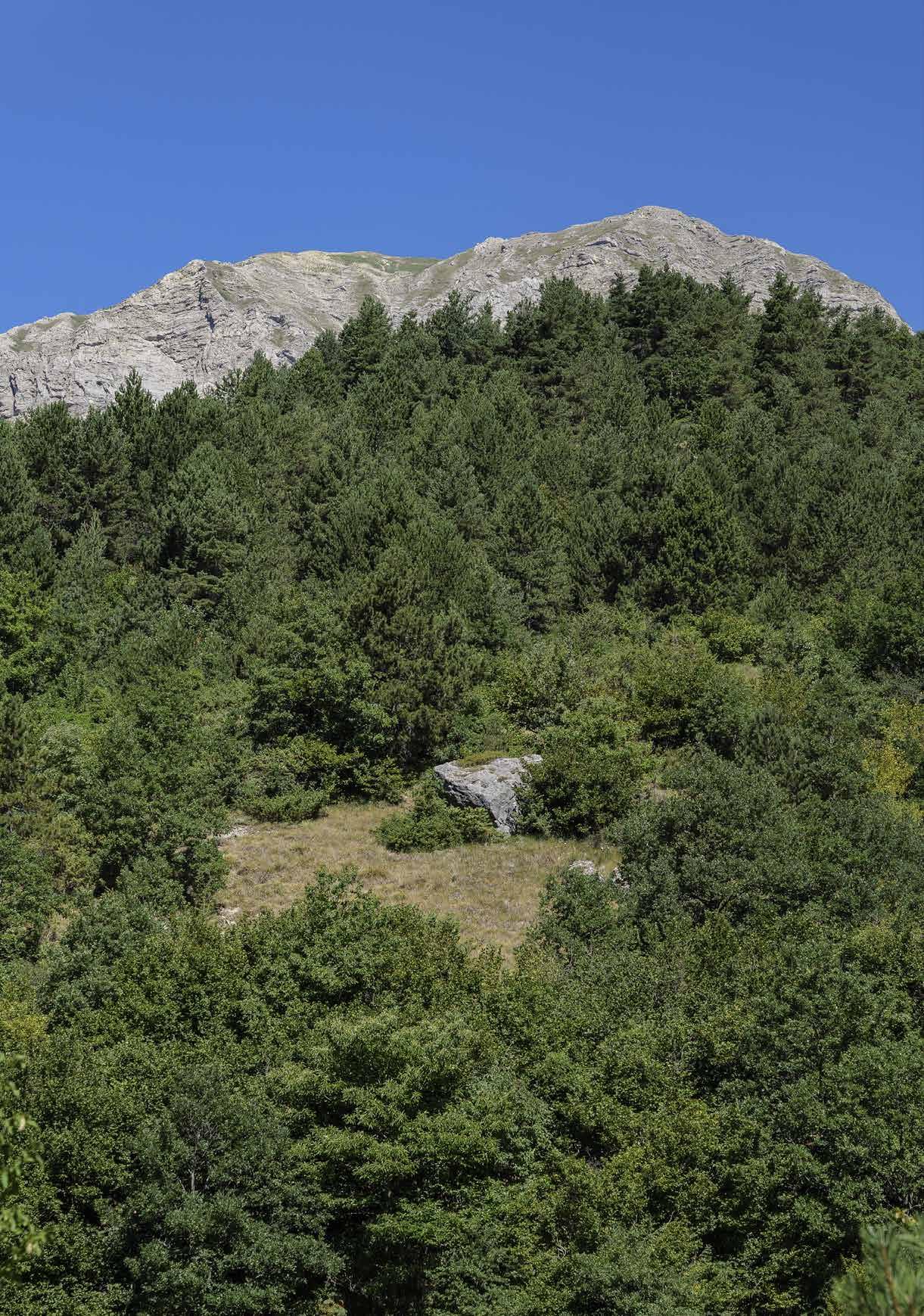
THE MUNICIPALITY OF ARQUATA DEL TRONTO IS THE ONLY IN EUROPE INCLUDED BETWEEN TWO NATIONAL PARKS: THE MONTI SIBILLINI PARK TO THE NORTH AND THE GRAN SASSO AND MONTI DELLA LAGA PARK TO THE SOUTH. A PECULIARITY THAT MAKES ITS TERRITORY UNIQUE.
Moreover, in addition to these two, better-known mountain ranges, the Arquatan territory also includes a third one: the Monte Ceresa range, situated on the border between these two national parks.

On a geomorphological level, the Sibillini chain is made up of limestone, a particularly friable material which over the centuries lead to the formation of a certain number of caves (the famous Sibilla cave, for example, located on the Sibilla mountain, as well as the Fairies’ cave).
The Tronto river bisects the territory, separating the Sibillini range from the Laga and Ceresa, which are more similar to each other being composed mainly of clay. Therefore the water, remaining on the surface, generates more watercourses on its slopes, consequently making the vegetation more luxuriant.
The vegetation of the territory is typical of a mountainous environment.
From 500 to 1000 metres, black hornbeam, ash tree, downy oak, oak forests and, of course, chestnut trees prevail, while on the limestone walls, holm oaks predominate.
Altitudinal zonation between 1000 and 1750 metres, on the other hand, is characterised by a large presence of beech, maple and whitebeam.
38
2 THE TERRITORY
At these heights it is easy to find early bloomers including snowdrops, scilla, coralroot bittercress and anemone, as well as mushrooms such as porcini, field mushrooms, golden chanterelle and Caesar’s mushrooms. The area around Pescara del Tronto is well known for its black truffles.

Between 1750 and 2000 metres and above, nature becomes subalpine, and then alpine. The environment is dominated by vast pastures and shrubs, such as dwarf pine, dwarf juniper, bilberry, bearberry, alpine poppy and edelweiss.
Local fauna is very rich and includes some endangered species such as the wolf and the Marsican brown bear. Then along the trails it is possible to come across deers, chamois, foxes, wild boars, roe deers, wild cats, badgers, polecats, weasels, martens, crested porcupines and numerous rodents, such as nutria. Rivers are full of trout.
The ornithological fauna is also of great interest. The golden eagle populates Mount Vettore, while among the birds of prey that inhabit these areas are the kestrel, tawny owl, peregrine falcon, eagle owl, buzzard and sparrow hawk, as well as other rare birds like alpine chough and coral chough. Among the reptiles, the Orsini’s viper and three different types of newts shall certainly be mentioned: the Alpestre, the Crestato and the Punteggiato. While a small crustacean, the Marchesoni’s Chirocephalus, is an endemic species located only in Pilate’s lake.
In addition to so much biodiversity, it is also necessary to mention that this area allows visitors to pass on foot from one mountain range to another one, as well as from one National Park to another via trails.
ARQUATA DEL TRONTO 39 TRONTO

PRETARE PIEDILAMA CAMARTINA SPELONGA TRISUNGO COLLE D’ARQUATA ACCUMOLI ARQUATA DEL TRONTO BORGO D’ARQUATA 5 6 7 8 9 11 10 12
THE RINGS OF THE ARQUATA DEL TRONTO’S FRACTION
ARQUATA DEL TRONTO 41
THE RING OF TRISUNGO
THE RING OF PRETARE
THE RING OF PIEDILAMA
THE RING OF SPELONGA
THE RING OF CAMARTINA - FORCA DI PRESTA
THE RING OF COLLE
THE RING OF BORGO D’ARQUATA
ACCUMOLI - PANTANI- CAPODACQUA RING ARQUATA DEL TRONTO
5.
6.
7.
8.
9.
10.
11.
12.
THE RING OF TRISUNGO
ALONG THE SALARIA ROAD, AMONG CENTURIES-OLD CHESTNUT GROVES
Km: 4,84


HOW TO GET THERE
The itinerary starts from Trisungo. The ancient path connecting with the village of Faete had been made into a carriageable road in the following decades, and was totally abandoned after the construction of the SP 20 road Trisungo-Colle.
In fact, the width of the initial track reaches six metres in some sections, making it also suitable for snowshoeing in winter.
The entrance to Trisungo is located in the highest part of the village, on the opposite side of the #Camminarquata information panel installed along the SP 20.
Walking time: 1 h 45’ Easy
Trisungo, Faete, the Chuch of Madonna della Neve, the Cioppeto ditch, Trisungo: this 4.8-kilometre-long loop trail runs along several intermediate stages and is particularly impressive.
From the main bridge in Trisungo, reach the upper part of the village, until crossing the path climbing into the forest on the opposite side of an information board, indicated by a wooden arrow. After 400 metres in the forest, cross the SP20 again, then re-enter the forest and, continuing on, come out in Faete just before the Church of San Matteo, near the football pitch.
Leave the SP 20 to enter Faete, pass by the SAE area and ascend along the main road reaching soon the Church of Madonna della Neve (Virgin Mary of the Snow, 878 m), located just above the village.
Once passed by the church, continue to climb along theep incline for about a hundred metres. Once completed
the next wooden sign on the right-hand side the entrance into the woods on the left, leaving the main road. Descend along the Fosso del Cioppeto, characterised by the presence of splendid centuries-old chestnut groves.
IL G.A.D.A. IN 4 TAPPE 42 THE RINGS OF THE ARQUATA DEL TRONTO’S FRACTION
5
 › The stone bridge connecting two districts of Trisungo
Here, you must follow the horizontal signs carefully because there is no real path: in fact, this track is running entirely through the forest. Pay particular attention because in some places the ground can be slippery, due to leaves and slope.
At the end of the Fosso, after passing by some Pecorino vineyards, the track joins a mule track on the left, leading back to Trisungo.
The village of Trisungo is the heart of this itinerary. Situated on the edge of the ancient Salaria consular road, on the right bank of the Tronto river, at an altitude of 601 metres, it offers an enchanting view of the fortress of Arquata del Tronto. Its name derives from lemmas ‘tres’ and ‘jungo’ (three and conjoin), indicating the point where the three roads crossing the town meet: the Salaria road, the Vorsus going in direction of Borgo d’Arquata and continuing on to Forca di Presta, and the road leading to Spelonga.
By the 16th century, the settlement had grown considerably and the old parish church of St Giacomo was already too small for the needs of local citizens. For this reason, the

a petition to San Giovanni in Laterano, in Rome, asking and obtaining the permission to build a new religious building on the opposite bank of the river.
The church of Santa Maria delle Grazie, completed in 1585, thus joined the church of San Giacomo in worship. With a single nave, it has a gabled roof, a 16th century portal with 15th century decorative elements and a bell tower built of local sandstone. Decorated with wall frescoes and an altar dedicated to the Virgin Mary, a niche was opened on the left wall in 1832 to create an aristocratic tomb; later, another cavity was opened to house the wooden altar dedicated to the Cristo Morto and Madonna Addolorata.
44
THE
› Church of Madonna della Neve nearby the cemetery
RINGS OF THE ARQUATA DEL TRONTO’S FRACTION
The place of worship was restored in 1932 and, on that occasion were found seven frescoes by different authors, dating from the late 16th and 17th centuries. The most interesting, apart from the Virgin Mary Enthroned with Child by Sebastiano Ricci, is the one in the centre of the right wall, depicting St Antony Abbot in a blessing attitude. In the background is a rural landscape with birds
upper right is a church, probably that of St of the Tronto river.
Strolling through the narrow streets full of history and charm of Trisungo, there is the oldest house in the town, dated back to 1500, discreetly preserved. Located in the Ponte district, it features interesting details on its façade, including an owl with apotropaic si-
winged face of an angel on another architrave, a frescoed niche above the entrance door and a walled shield engraved with the date 1515.
CURIOSITIES
A milestone from Roman times is preserved in Trisungo, on which an epigraph from 16 BC is inscribed. It documents the resolution of a Senate Consult with whom the Emperor Augustus ordered a conservative intervention on the Salaria road.
Found on 13 January 1831 in the riverbed of the Tronto at the height of the village, it seems that the cippus was originally located on the Via Salaria. This is further evidence of the strategic importance of this place of transit already in the time of the Roman Empire. Currently, the artefact is located near Laudi House, inside the village.

45
45
THE MILESTONE › Trisungo’s Roman milestone
ARQUATA DEL TRONTO
RINGS OF THE ARQUATA DEL TRONTO’S FRACTION

THE RING OF PRETARE DISCOVERING
THE ANCIENT OLD FURNACE
Km: 6,19
HOW TO GET THERE
The ring develops around the area of Pretare, a hamlet of Arquata del Tronto located at an altitude of 920 metres, at the foot of Monte Mount Vettore. The village lies in the heart of a beautiful valley between the Forca di Presta and the Galluccio mountain pass.
To reach Pretare, drive along SS4 Via Salaria road reaching Trisungo. Then follow the SP89 road for 5 kilometres passing by the hamlets of Borgo d’Arquata and Piedilama.
Walking time: 2 h intermediate

The ring of Pretare is part of the network of historic paths once used to reach the pastures in the area of Prato Comune. It is not a difficult hike, adapt to everyone , even if some difficulties may be encountered in reaching the summit of Mount La Tesa. It is a particularly interesting route, especially considering the landscapes.
Once left the vehicle at the SAE area of Pretare, start rising towards the upper part of the village, along the SP 89 road : pass by the “Da Cavallo” restaurant on the left and pass through all the hamlet. Continue uphill along SP 89 and, until reaching the last houses in the village. Once you reach the last bend to the left, take the asphalt road leaving the SP89 on the right side, where a small wall enclosing the courtyard of a house is evidenced by a pole with wooden arrows. Soon the asphalt gives way to a dirt road . At a wide hairpin bend, keep to the right. From this point, the path skirts the boundary of the Monti Sibillini National Park for a long stretch , and is flanked by the characteristic emblem boards up to an altitude of 975 metres.
Climb the Valle Stretta (“narrow valley”), until reaching
IL G.A.D.A. IN 4 TAPPE 46
6
THE
 › Mount Vettore covered by pinewood over Pretare
a dirt road leading back to SP89, the asphalt road which has to be followed for about 50 m on the right.
Go forward to Passo del Galluccio (1197 m), beyond which there is an Enel cabin. Then start descending to the right until Colle il Galluccio (1175 metres) in 5 minutes, before entering the evident mule track to the right, taking trail 503 which heads to Prato Comune.
Before reaching Prato Comune, at a high summit saddle (1100 m), the path arrives at Colle la Tesa (1171 m) where an iron cross is positioned .
Return to the right, leaving the gravel road number 503 for path number 552, which enters a predominantly oak forest and descends with a series of bends towards south-east. Continue until the path, which becomes increasingly wide and evident, re-enters the forest and reaches the Pretare Cemetery (909 m). Following the small road, which starts at the entrance to the church, cross a small bridge over the Morricone ditch to return to the SP89 road, soon leading back to the starting point.
Outside the village of Pretare, the old furnace is located, a place rich in history and charm. To reach it by car, climb the winding road going from the village to Forca di Presta.
The remains of this ancient construction testify to its important use. It appears as a truncated tower with a square plan, made of stone ashlars and red bricks . At its base, the void formed by the arch can still be seen. Built in 1928 near the source of raw material, limestone, this kiln was used for calcining rocks, i.e. for the production of quicklime.

48
48 THE RINGS
› The path descending towards the village
OF THE ARQUATA DEL TRONTO’S FRACTION
The process consisted of heating the limestone to temperatures around 800 degrees Celsius to decompose bicarbonate and carbonates. The rock was charged from above and the resulting lime was discharged downwards, without ever interrupting the operation of the kiln. The old Furnace represents one of the few archaeological-industrial testimonies of this area.
CURIOSITIES
THE RENOVATED REST AREA
In November 2020, Arquata Potest, with the support of several institutions (including BIM Tronto), started the redevelopment of the Old Furnace of Pretare rest area. In this way, a resting place crossed by the G.A.D.A., the Cammino nelle Terre Mutate, the E1 path and the GADA-Bike has been fully restored. The Furnace is located in a panoramic position along the SP 89 (the provincial road connecting this area to Montegallo and Castelluccio di Norcia), 800 metres after Pretare. The various interventions made it possible to equip the area with 70 metres of fencing, tables, benches, an information board and a barbecue area.

49
49 ARQUATA DEL TRONTO
› Rest area “The Furnace”
THE RING OF PIEDILAMA
DISCOVERING THE MIRACULOUS SPRING
Km: 9,37

HOW TO GET THERE
Park in the SAE area of Piedilama. Head up towards
internal road on the right: the one with with directional wooden arrows close-by. From here, continue to the left. After the last houses of the hamlet, at the next fork of the road, take the dirt road going uphill to the right. Continue until reaching a second fork in the road, take the road to the left and begin the ascent towards Prato Comune, along a comfortable track (avoiding the dirt road to the right, which leads to Borgo di Arquata).
Walking time: 3 h Intermedia
sed by its great scenic interest. Between April and June,

Park can be admired. In winter, with good snow cover, it can also be walked with snowshoes.
Once leaving Piedilama in the direction of Prato Comune, proceed until reaching a metal cross on your left, which recalls Christ’s passion on Mount Calvary. At this point, turn left entering the forest pointing north.
The path now proceeds into the woods, soon reaching a stream to be crossed. From here, the path climbs again, leaving the forest and reaching grassy slopes, in the direction of Pian Pecorelle, where it is necessary to follow the signposts until re-entering the forest again. From this
the trees, following the GPS track if possible.
Begin to climb through the forest, reaching an easy track (path 503): the directional arrows indicate to go left, following the road to Colle di Galluccio.
After passing a fountain, in about 200 metres at an obvious hairpin bend to the right, leave the road and continue along the path to the left, towards Pretare.
IL G.A.D.A. IN 4 TAPPE 50 -
7
THE
TRONTO’S FRACTION
RINGS OF THE ARQUATA DEL

›
Sant’Egidio’s Spring
At the next fork, take the road down from the Tesa hill. From here, the road is narrower, with the possible presence of ferns or weeds. At the next fork, go left, passing by Pretare cemetery and soon reaching the village (920 m).
Near the SAE area, just after the Rifugio degli Alpini restaurant, on the right, there is a small road leaving the SP 89 and running alongside the municipal park. Take it, continuing to descend for about a hundred metres, leaving some storage sheds and -

ting with meadows.
Go forward paying attention to the horizontal markings along the route, which continues southwards, passing the ruins of an old mill (avoid approaching as the structure is unsafe), amidst stretches of woodland and openings over the valley, almost parallel to the Fosso della Pianella and the SP 89 road.
About halfway along the route, you will arrive to Fonte Sant’Egidio, a spring of drinking water gushing out at the foot of a huge rock forming a cave.
A statue of Sant’Egidio, the patron saint of Piedilama, is placed at its foot. The inhabitants of this hamlet consider the spring miraculous and therefore are used to use its waters to make compresses or to quench the thirst of sick people.
Once passed by the spring, continue to descend pointing south, a footbridge running alongside a ditch (which is quite full of water in spring, when greater care must be taken), and then crossing a small wooden bridge to return to Piedilama, following the signs.
Piedilama is the only red zone present along the ring. When crossing these 300 metres, -
gs) and the GPS track that allow you to cross the area safely without approaching buil-
52
52 THE
› Pretare, wooden signposts nearby the municipal park
RINGS OF THE ARQUATA DEL
TRONTO’S
FRACTION
dings. Once past the red zone of Piedilama, we reach the SP89 road again, which in the last stretch leads to the SAE area.
A curiosity about this hamlet’s name, which derives from the fusion of two terms: ‘feet’ and ‘lama’, which means landslide. The meaning therefore goes: village built at the foot of a landslide. A sign of tenacity and resilience, which we hope will be a good omen for the future.
In fact, this small village was also hit by the earthquake tremors of 2016. On 30 October, the strongest one, with a magnitude of 6.5, almost razed the village to the ground, causing collapse not only to the houses, but also to the west wall of the modern Church of Madonna della Pace and its bell tower.

CURIOSITIES
THE EUROPEAN PATHWAY E1
It starts in North Cape (Norway), passes through Sweden, Denmark, Germany, Switzerland and Italy and ends, after about 7000 km, at Capo Passero in Sicily. We are talking about the European Path E1, a long-distance route born from the dream of uniting the peoples of the old continent. Among the Italian municipalities crossed by this pathway, Arquata del Tronto is crossed by two routes: Castelluccio-Borgo di Arquata (which includes the hamlet Piedilama) and Borgo di Arquata-Accumoli.
53
53
› Piedilama, end of the path through the “red zone”
ARQUATA DEL TRONTO
THE RING OF SPELONGA ON THE TRAIL OF THE HERMITS
Km: 9,37


HOW TO GET THERE
The itinerary starts from Spelonga, exploring the routes of Monte Civita (1049 m) which connect it with Faete.
The small hamlet can be reached by leaving the Salaria road at Trisungo and ascending the SP 20 road passing through the hamlet of Faete. The heights encountered along this route were chosen by saints, anchorites and hermits to lead a mystical and ascetic life, in the quiet and serene isolation of impervious mountains, considered the altars of God.
Walking time: 3 h Intermediate
The village of Spelonga consists mainly in houses built in the 15th and 16th centuries: many of them still retain their ancient appearance, with stonewalls, external stairways and small loggias. Starting from the Church of Sant’Agata, in the main square, descend in a northerly direction , following the main road until leaving the last houses of the village near the SP 20 road Trisungo-Colle. Once reached SP 20 , on the opposite side of the road, enter the path, marked by a wooden sign , descending for the first 800 metres in a northerly direction.
This first downhill section is rather steep. Hikers, however, will be amply rewarded by the presence of beautiful dry stonewalls, often present on both sides of the path, in some points even reaching two metres in height. Moreover, a few well-preserved sections of paving helped pack animals in the past to cover this road. Until the 1950s, the SP 20 road did not yet exist and these paths were the only viable routes : they were so precious that local people contributed to restoring all year long compromised sections, sending representatives from each family several times per year.
IL G.A.D.A. IN 4 TAPPE 54
8
FRACTION
THE RINGS OF THE ARQUATA DEL TRONTO’S
 › Chestnut woods nearby Spelonga
After the first 800 metres downhill, pay attention to the wooden signs indicating the turn to the right towards Faete , continuing the route on its flatter side. Along the path, you will enter the hamlet of Faete, perched on a rise from which there is a panoramic view of the castle (Rocca) of Arquata.
Once passed by the SAE area, continue on the main road which climbs eastwards reaching the Church of the Madonna della Neve (Virgin Mary of the snow), located just above the village. Built in the 15th century, externally it has a large portico resting on square-based columns in support of the exposed trussed roof. The interior is very simple, with a single nave, and preserves precious 15th-century frescoes, painted in the style of artists Panfilo da Spoleto and Pietro Alemanno.
In the past, especially in the Marche region, churches, chapels and votive shrines dedicated to Virgin Mary of the Snow were built in so-called “neviere” (places for collecting and storing snow, created to help communities in conserving food).
From the crossroads in front of the church, keep on straight along the main road, ignoring the dirt road climbing up Monte Civita. At the first crossroads, after 500 metres, remain again on the main road . From here on, several tracks enter the forest, made by lumberjacks, so it is essential to follow the signs at

56
FRACTION
› The Festa Bella: the pole raising THE RINGS OF THE ARQUATA
DEL TRONTO’S
the crossroads (even better GPS track) until the Church of the Madonna dei Santi .
Completely surrounded by nature, amidst green forests and pastures, this very intimate-looking place of prayer has a gabled roof overhanging the façade and a small bell gable. Just below the Church, in direction of Spelonga, there are two large boulders in the forest on which we can read interesting engravings, such as crosses and ladders, inscriptions with names and dates that, according to popular tradition, can be traced back to fertility rites that took place in the area. Continue then along the main road, until reaching a crossroads: take the road in the centre going downhill, which shortly returns to Spelonga.

CURIOSITIES
THE “FESTA BELLA” (BEAUTIFUL FEAST)
Every three years, Spelonga commemorates the Battle of Lepanto of 7 October 1571, the great naval clash between Muslim and Christian forces. In August, the village organises a re-enactment called Festa Bella, much loved by locals and tourists alike. It is said that a hundred of people from Spelonga took part in the battle taking possession of a it back to their hometown as an heirloom of victory. Since then, this precious relic, consisting in a red cloth banner with three half-moon and one star in the middle, has been jealously kept in the town’s parish church.
57
› Church of Madonna dei Santi
57
ARQUATA DEL TRONTO
THE RING OF CAMARTINA AND FORCA DI PRESTA IN THE
FOOTSTEPS OF GIUSEPPE AND ANITA GARIBALDI
Km: 13

HOW TO GET THERE
This route is practicable all year round, but it is not recommended during winter months, in case of rain or snow.
Once parkedat the S.A.E. area of Borgo1, pass by the sports the crossroads. Proceed along the road through the village of Borgo d’Arquata, located along the ancient via Salaria (today’s SP 129 road).
After about 500 m, at the crossroads, turn left again and then, past a drinking fountain, take the right, following signs heading to the hamlet of Camartina.
E (Intermediate)
Walking time: 4 h 55’
Part of this route was travelled in January 1849 by Giuseppe Garibaldi and his escort on their way to Rome The general recalled this stopover in his Memoirs as follows: ‹We crossed the Apennines, over the steep heights of the Sibyl, the snow was raging. I saw the robust populations of the mountains, and we were well received, celebrated everywhere, and escorted by them with enthusiasm.»
After all, as historian Giuseppe Castelli wrote earlier in the 19th century: ‹Here passed through all the ethnographic migrations, all the trade caravans, all the armies which most contributed to the history of Italic civilisation, from the age of the Aborigines to the Middle Ages›.
From the small square of Camartina, continue straight ahead, keeping the watercourse on the left until crossing it on a small bridge, where the asphalt gives way to a dirt road.
either turn right, following the GPS track along a steeper and less scenic route, or left, passing through the area›s
at an altitude of 1,000 metres with very fresh water (which

IL G.A.D.A. IN 4 TAPPE 58
9
THE
OF
TRONTO’S FRACTION
RINGS
THE ARQUATA DEL
 › The Rifugio degli Alpini, in Forca di Presta
supplied Arquata› before the Pescara Aqueduct was built).
The two possible branches of the previous junction meet near the ruins of the ancient
in the direction of Fonte Cappella.
After about 800 metres, ignore the small path climbing to the left and keep the main road.
After about a kilometre, a sharp bend shows on the left the junction with a bar in the direction of Fonte Cappella: take this track to reach the springafter 100 metres.
From Fonte Cappella, continue along path no. 103, which ascends into the forest to the left of the spring. Go further ahead, keeping to the right of the ditch and then climbing up to the left, until we take the path which cuts almost horizontally to the left of the long slope.
Continue along this path until the asphalt road at Forca di Presta (1536 m). Taking it, we reach via the GAS (Grande Anello dei Sibillini) the Rifugio degli Alpini (still closed for earthquake damages).
From here, take the “Sentiero per tutti” (Itinerary for everybody).
Beyond the Refuge, a cottage is visible at a distance under the road. About 200 m before reaching it, follow the markers to the left. Reach vast meadows where a path continues across the slope. Along this path, sometimes disappears among the grass, we skirt a deep wooded valley (Buco d›Urie), before descending directly to the slope, which becomes steeper. Turn right to cut across the slope, pass over a ditch, and return to an open meadow after the woods. ,
and passes by a small stone gully, beyond which it descends to the left into a large clearing. Keeping in the middle of the track, enter the forest at the point marked by the stone men

60
60
› Hiker on the trail
THE RINGS OF THE ARQUATA DEL TRONTO’S FRACTION
(small clusters of white stones) where the
Coming out from the forest, descend along the wide stony ridge and, keeping to the right, we reach Fonte le Trocche. From the spring, head to the left on one of the many tracks for about 200 metres, before descending directly down the slope towards an evident, sharp ridge coming out from the forest below. Once reached it, keep to the left, where the path becomes recognisable again and steeply descends along the Vena dei Corvi. Once reached the base of a rocky drop (visible on the right-hand side), the track seems to disappear. From here on, it is essential to maintain the wooded ridge where the track is clearly visible, until reaching the track of path 107 again.
continuing downhill. At the next fork, turn left to descend again towards Camartina.
CURIOSITIES
ANITA’S ROSE AND THE ACADEMY OF OPLOLOGY
The passage of Giuseppe Garibaldi in Arquata del Tronto is dated 26th of January 1849, when he was hosted by the Ambrosi family. A plaque installed in Via Garibaldi celebrated the Hero of Two Worlds. To commemorate the event and with to honour the charismatic
rose dedicated to her was planted in the Borgo1 village in August 2022. This initiative was part of the international Anita Fidelis project, promoted by the Centro Studi Olim Flaminia, in collaboration with the Accademia di Oplologia e Militaria of Ancona and Arquata Potest.

61
› Rest area “La Botte”
ARQUATA DEL TRONTO
THE RING OF COLLE D’ARQUATA
ALONG THE BORDER BETWEEN LAZIO AND LE MARCHE
Km: 12,9

HOW TO GET THERE
This route is an EE: only for esperts hikers. That is why it is necessary to use the GPS track, both because signposts are present only in the initial part (from Colle until the hermitage), and because of the

which remain unclear and quite complex even if following the track.
The itinerary starts from Colle d›Arquata, more precisely from the Ramazzotti Bridge, connecting this hamlet with Poggio d›Api. Near the bridge, it is possible to park your vehicle before starting the trek.
Walking time: 4 h
From the bridge, keeping the left side, follow a short ramp descending between last houses of the village and then climbing up some steps to a steep slope paved with sandstone walls. This will lead you to the church of Santa Maria della Rocca (also known as the Church of the Madonna del Divino Amore, 1108 m), on the summit of the overhanging Monte Rocca.
After the Church, take the path running between spectacular rocky ridges heading to the valley of the Vargo stream, a tributary of the Chiarino river.
Having forded the stream, continue along a track climbing up into the forest, passing several clearings and, after a few wide bends, joining another evident path, until it reaches a dirt road. After a while leave the dirt road for a path on your left, until reaching the altar dedicated to the Madonna del Chiarino, near which there is a spring and the Hermitage of Sant›Amico di Avellana, who lived here between the 10th and 11th centuries.From this point on, signs are no longer present.
From this point on, signs are no longer present. Continue in the direction of the spring of Sant›Amico, located near the altar, to climb, following the GPS track, to Fosso (ditch) dell›Inferno.
IL G.A.D.A. IN 4 TAPPE 62
10
FRACTION
EE, for expert hikers
THE RINGS OF THE ARQUATA DEL TRONTO’S
 › Altar dedicated to Madonna del Chiarino
Continue 700 metres uphill reaching a ditch with water. After 200 metres, do not continue on level ground but intercept the cart track after a hairpin bend and proceed for another 400 metres. From here, fold two more ditches, not far from each other, after which we will have reached the highest point of the itinerary, at an altitude of almost 1600 metres.
After fording another ditch, reach the road coming up from Illica, which has to be followed downhill to the right. After about 400 metres we come across the WWF Oasis of Lago Secco or Lago Nero, surrounded by a fence. With its beech forest alternating with high-altitude pastures, the oasis is surrounded by a dense network of springs, streams, lakes, peat bogs and pools of various sizes, which make the landscape pleasant and lively. In the centre of this wetland area, in addition to Lago Secco, there is also Lago della Selva, which represent the main non-seasonal stretches of water in the area.
descending a steep slope until it meets a path that, to the right, leads to the nearby Agro Nero spring, also fenced off, which gushes out at an altitude of 1,500 metres from a pool of water. To reach Lago della Selva, on the other hand, turn back along the path, skirting a small lake located in a hollow with a solitary beech tree, ascend slightly to the left and, following a depression, head to the right to reach this splendid pond, hidden in the forest, surrounded by a fence and only visible from very close by.
isolated beech tree, descend to the right (north-east) into the amphitheatre of the Fosso meadows, then into the forest).
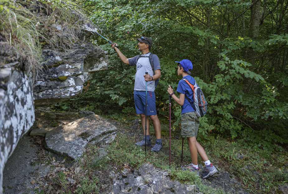
64
64 THE
› Hikers exploring the structure of the rocks
RINGS OF THE ARQUATA DEL TRONTO’S FRACTION
Immediately after the source of the Agro-
Negro, go over the spring, ascending slightly to take the mule track leading to Colle di Pietro, and then leave it by descending to the left onto the dirt track which corresponds to path 375.
Shortly after, the road becomes more marked: travel through a small valley and, ignoring minor diversions on the right, reach a fork located near a bend, just before the track crosses the Fosso della Valle in Su.
Leaving the left-hand path leading to Poggio d’Api, follow the right-hand path that branches after a slight climb. Turn left, keeping to the main track which descends in steep serpentines (ignore the detours to the right) and joins the Colle-Poggio d’Api road.
Following it to the right, in 450 metres we reach Ponte Ramazzotti and Colle in direction of the hamlet of Poggio d’Api. In the directly to Colle.
CURIOSITIES
BETWEEN FAITH AND LEGEND
The cult of Madonna del Chiarino (Virgin Mary of Chiarino river) is still alive in this area. It is
the ancient hermitage located in the mountains of Colle (where Saint Amico lived), disappeared several times from its new home, the church of San Silvestro, to be found again each time on the hermitage, into the mountains. This happened until a small window was made in the church of San
to always face the hermitage. Even today, with a torchlight procession in September, the believers retrace the ancient mule track from the hermitage to Colle.

65
› Church of San Silvestro
65 ARQUATA DEL TRONTO
THE RING OF BORGO DI ARQUATA
ALONG THE SOUTHERN SIDE OF MONTE MOUNT VETTORECTOR
RINGS OF THE ARQUATA DEL TRONTO’S
Km: 16,4

HOW TO GET THERE
in Borgo, the hamlet of Arquata located at the foot of the hilltop town.
Park the vehicle in the SAE area of Borgo1, which is served by a bar and a grocery shop, and start our route passing by the football pitch. Reach the crossroads and turn left.
Proceed along the SP89 road through the built-up area of Borgo d’Arquata, pass by the Church of San Francesco and after about 500 m, at the
and then immediately to the right, ascending in direction of Camartina.
E (Intermediate)
Walking time: 5h 05’
Once left the small square in Camartina, continue straight ahead, keeping the ditch on your left. A few hundred metres further on, once on the dirt road, turn left at the crossroads -
After about a kilometre, two more forks must be kept to the right, passing by the Vena de Corvi (945 m).
Continue climbing until, after a couple of hairpin bends, a picnic area near the spring called La Botte. This water source supplied Arquata since ancient times, before the construction of the Pescara aqueduct.
The itinerary climbs up to the ruins of the ancient house of Count Gallo and then reaches a fork in the road: keep on straight ahead.
The road continues to climb with a slight incline, offering sweeping views of the Laga Mountains, as you approach the beautiful slopes of Mountonte Vettore (2478 m).
About six kilometres from the start of the route, a sharp bend shows on the left the fork in the direction of Fonte

IL G.A.D.A. IN 4 TAPPE 66
11
FRACTION
THE
 › Borgo d’Arquata, with Mount Vettore in the background
Cappella (after about 100 metres), another possible and pleasant stop to refuel with water. Otherwise, you can continue to the right, along the track which reaches Colle del Quarto, a place also known as Picchio7 (1280 m). This is a scenic natural balcony over the Tronto river valley and the surrounding chains, in the past used as a lookout
At this point, the path joins SP 89 road: descend to the right, continuing for 500 metres and then return further to the left, back into the forest, crossing the pine forest of Pretare and then descending along the path known as the Veticare.
Before arriving at Pretare, pass by the old furnace with a pleasant rest area. From here, Piedilama can be reached in two ways: either take the SP 89 road for about two kilometres, or else pass into the woods along the Fosso della Pianella. In the second case, after the Rifugio degli Alpini restaurant, there is a small road on the right running alongside the municipal park. Take it, continuing to descend.
right, before the path begins to enter the woods, alternating with meadows. Go further, paying attention to the horizontal markings along the track continuing southwards, passing by the ruins of an old mill (avoid getting close, as the structure is unsafe). Amidst stretches of woodland and openings over the valley, almost parallel to the Fosso della Pianella and the SP 89 road, this path connects the two hamlets.
Fonte Sant’Egidio, a spring of drinking water gushing out at the foot of a huge rock, which forms a cave. A statue of Sant’Egidio, patron saint of Piedilama, has been placed at the foot of this spring. The inhabitants of the hamlet believed the spring to be miraculous, so much that they used its waters to make healing compresses.

68
68 THE
› Ruins of an old mill
RINGS OF THE ARQUATA DEL TRONTO’S FRACTION
a small wooden bridge. Returning to Piedilama’s red area, please always follow the signs.
Once crossed the town centre, reach the SP89 road again, which in the last stretch leads to the SAE area of Piedilama, where a bar is located.
Continuing towards Borgo, it is not necessary to reach the SAE area: take the small road on the left, which from SP 89 enters the village (marked by a wooden signpost arrow), along the path connecting Piedilama and Borgo.
Leaving the last houses of Piedilama behind us, we keep to the right at the next two crossroads.
The mule track begins to climb for a couple of kilometres in direction of Colle Forcella, which, once reached, offers splendid views of the surrounding ranges, with the eye sweeping from Mountonte Vettore, the king mountain of the Sibillini range, to Pizzo di Sevo (2419 m), in direction of the Monti della Laga. -
rest, then one through the trees, until it reaches a fork. Here, you straight ahead we would reach the Belvedere San Francesco, a panoramic viewpoint over Arquata. To continue towards Borgo, however, turn left at the fork, continuing down the Pisciallonga coast.
Now the road is no longer the comfortable mule track it was before, but a small path through the forest, passing over the top of the Macchia di San Pietro, descending
it joins a dirt road, where at the fork we turn left and continue our descent. Keep on the main road, ignoring the path on the right leading to Fontanile Palombini, a non-drinking water source.
We continue to descend to the village of Borgo (685 m), which offers views of the city of Arquata.
CURIOSITIES
Not everyone knows that in the Church of San Francesco in Borgo, until 24 August 2016, a faithful reproduction of the Holy Shroud venerated in Turin was held. It is the Holy Shroud of Arquata, which can be distinguished from original one by the inscription in the centre ‘EXTRACTVM AB ORIGINALI’. The damage suffered by the Church during the earthquake made necessary to temporarily relocate it to the Cathedral of Sant’Emidio, in Ascoli Piceno. The parchment signed in Alba on 1 May 1655 by the notary Sanzia and the bishop and Count Paolo Brizio
in contact with the Turin Shroud at the request of Bishop Giovanni Paolo Bucciarelli, native of Arquata and secretary of Federico Borromeo (the cardinal of “I Promessi Sposi”). A second contact took place in 1931, during the ostension of the Shroud. These contacts are intended to reinforce the sacred powers of the copies, which, according to popular belief, are passed on to the reproductions when they are created. The relic has been jealously preserved for centuries by the friars of the convent dedicated to St. Francis, who came to Arquata in 1215 on an apostolate mission. It seems that the copy was requested in order to have an ecclesiastically owned Shroud, either because the one in Turin belonged to the Savoy family, and also to keep the relic in a private and safe place in case something would happen to the original one.
69
THE SHROUD OF ARQUATA ARQUATA DEL TRONTO
ACCUMOLI - PANTANI - CAPODACQUA RING
BETWEEN FORESTS, PONDS AND BREATHTAKING VIEWS
Km: 19,8

HOW TO GET THERE
Once the vehicle is parked near the Accumoli cemetery, climb up a small asphalt road in a north-eas direction. After one kilometre, reach the Church of Madonna delle Coste (1020 m) and the Alta Montagna Bio agritourism (1034 m). From here, the route starts. Head out on this itinerary with plenty of water, as there are no spings along the route. We also recommend avoiding the Pantani-Capodacqua and Capodacqua-Madonna delle Coste sections during hunting season (mid-September to the end of January).
Walking time: 6 h 30’ EE, for expert hikers
Starting at the Alta Montagna Bio agritourism, continue in wide bends through the forest on the dirt road (which is cemented for long stretches) climbing the east ridge of Monte Ciambella
Leaving a telecommunications installation to the left, exit the forest onto the pastures of Torrione (1224 m) in view of the Laga range, Mountnte Vettore and Gran Sasso. We thus reach a fork in the road from which we continue to the right, still climbing. We arrive below the south-east ridge of Costa Castelluccia (1426 m).
After two hairpin bends, the road makes a long traverse in a north-westerly direction, passing halfway to the left of Costa Castelluccia and La Civita.

Continue until reaching Forca dei Copelli (1625 m). At this point, with a diversion to the left, we can descend a few tens of metres into the Valle dei Cupelli, to the Fonte dei Copelli spring, at an altitude of 1585 metres, to refuel with water.
Back at the Forca dei Copelli, we descend in a northerly direction and soon reach the ponds called Pantani (1587 m).
We are in a unique panoramical area, overlooking the small lakes of the Forca dei Pantani (1607 m), where Umbria, Lazio and Le Marche meet.
IL G.A.D.A. IN 4 TAPPE 70
12
TRONTO’S FRACTION
THE RINGS OF THE ARQUATA DEL
 › The Pianist on the beetle car at Pantani
THE RINGS OF THE ARQUATA DEL TRONTO’S FRACTION
From here continue to a fork in the road and take the right, in north-east direction, bypassing the Pantani. Walk along the fence enclosing these ponds until reaching the entrance to the small lakes. Follow a small road that reveals itself a short distance to the left, indicated by a small wooden pole.
About 250 metres further on, pass by the refuge of the Comunanza Agraria di Capodacqua (damaged by the 2016 earthquake) to arrive at a crossroads, where the path continues straight along the marked road before entering into the forest.
From here, a path starts where the downhill slope will increase sharply: the next 4.5 kilometres will be characterised by a steep gradient.
Descend for 500 metres into the forest and at the end, turning right, come to a meadow.
Continuing, you will go in and out of meadows and forests several times, before rea-
start of the descent, passes under the SS 685 road.
Once reached a yard, take the dirt road and continue downhill for about 500 metres along the Capodacqua valley, until a lovely rest area on the right, consisting of a stone barbecue and some seats.

Keep on descending on the easy road for another 500 metres, until reaching Capodacqua, hamlet of Arquata del Tronto. The village is still a red zone and entry is prohibited. It is therefore necessary to stay on the marked route, which, before reaching Capodacqua, takes the obvious dirt road climbing to the right, staying away from damaged buildings on your left.
For about 1.5 kilometres uphill keep the main road through the forest, ignoring small paths on both sides.
After about 20 minutes from Capodacqua, a fork is located at the exact point of the
72
-
› Capodacqua, the octagonal church of Madonna del Sole
border between Le Marche and Lazio. Take the right road and proceed towards Accumoli.
From this point, pay attention, as there are numerous deviations. The chestnut groves in the area now give way to oak trees. Take the uphill ridge to the right and keep straight ahead for about 500 metres. At the next fork, take the path to the left. After another 100 metres, turn right onto the uphill path. Continuing on, there are rests of a small hunting lodge on the right. At 150 metres from the last fork, take the path further uphill on the right.
Keep this direction, continuing to ignore small paths on both sides, climbing for about 300 metres before crossing the old road connecting Capodacqua and Accumoli. Continue to the left following the path for about 250 metres before coming to a narrow track on the right, which climbs into the beech forest. After 250 metres, on the left,you will notice a series of small huts belonging to hunters: continue straight ahead along the path, which is not very evident but is nevertheless signposted, ignoring the diversions downhill on the left. After 200 metres, re-enter the forest.
The track now becomes narrower with exposed sections and it is necessary to proceed with caution as the slope descends rapidly into the valley. After about one kilometre, having reached a fork in the path, we opt for the less obvious path climbing to the right. It is recommended to follow always the signs, especially in this section. After a few metres, the path becomes a gully. Walk about 600 metres uphill, where a viewpoint shows the Laga range.
Continue straight ahead and after 1.5 kilometres, near the Alta Montagna Bio agritourism, reaching the road coming from the Pantani and leads, after 300 metres, downhill to the Church of Madonna delle Coste. Continuing for one more kilometre, we reach the SAE area of Accumoli again.
CURIOSITIES
THE WONDERS OF CAPODACQUA
The hamlet of Capodacqua, whose toponym refers to the local springs, is located at an altitude of 880 metres. It is characterised by the presence of large chestnut wooden balconies of early medieval origin (bbufìri, in dialect) and the octagonal temple of the Madonna del Sole, designed by Cola d’Amatrice and erected by local community in 1528.
of art, the inhabitants of a small mountain village literally took the bread out of their mouths. The interior features 16th-century frescoes, among which one in particular recalls a miracle that
of pastures between Capodacqua and Norcia. On that occasion, the
inhabitant of Norcia. In fact, a fog had risen and enveloped the inhabitants of Norcia while to the people of Capodacqua appeared the Holy Virgin of Carmel, guiding them. In remembrance of this event, an endorsed procession is still organised every three years in July by the Confraternity of Holy Virgin of the Carmel, the ancient religious institution founded in the mid-16th century, shortly after the temple was built.
One hundred men, covered in a white coat and a blue cape, set off on foot from the Temple of Madonna del Sole. Each of them represents one of the families which lived in the village at the time. At the end of the event, a large popular feast is held.
ARQUATA DEL TRONTO
73
73
AN HERITAGE TO BE RESTORED
THE DAMAGE CAUSED BY THE EARTHQUAKE, WHICH STRUCK ARQUATA IN SUMMER 2016, CAUSED THE COLLAPSE OF CENTURIES-OLD CHURCHES, WITH THE SUBSEQUENT CLOSURE AND TEMPORARY RELOCATION OF MANY ARTISTIC ASSETS TO SAFER LOCATIONS. THE COMMUNITY IS AWAITING RESTORATION WORK IN ORDER TO RETURN THESE SITES TO THEIR FORMER GLORY.
Churches awaiting restoration after the earthquake
The damage caused by the earthquake, which struck Arquata in summer 2016, caused the collapse of centuries-old churches, with the subsequent closure and temporary relocation of many artistic assets to safer locations. The community is awaiting restoration work in order to return these sites to their former glory.
The rebirth of Arquata del Tronto also passes through its main symbol: the medieval fortress, which dominated the Via Salaria for a thousand year, is waiting to return to


Arquata is rich in evidence of a millennial past made up of religious, civil and military buildings: in fact, over the centuries, its strategic position has led to the continuous passage of armies, artists, pilgrims, nobles, hermits and merchants. For those coming from Rome, on their way to San Benedetto and the Adriatic sea, or going north to Senigallia, transit through this territory was a must.
Today, a few years after the tragic event, wandering among the ruined houses in search of the past is a sombre journey of memory.
74
3 IN_DEPTH ARTICLE
There are numerous places in the area that cannot yet be visited as are still waiting to be restored. First and foremost, the Church of the SS. Salvatore, where mass was celebrated once a year, which collapsed despite having just been restored. The earthquake did not even give the Arquatans the time to inaugurate it.
The church of Santa Croce in Pescara del Tronto, built by the Templars, was oriented towards Jerusalem before being destroyed by the earthquake. Among the valuables goods kept inside, fortunately one of the oldest astylar crosses in the Marche region was saved, which an unknown inhabitant, returning from the Crusades, brought back in the second half of the 13th century.
The church of the Madonna delle Grazie, in Trisungo, awaits the end of works, while that of Sant’Agata in Spelonga is currently under renovation.

In Colle d’Arquata, the church of San Silvestro is awaiting restoration, while that of San Sebastiano is the only brick church to be accessible in the entire municipality. The other places of worship in Borgo1 (in the SAE area) and Pescara are panelled structures built after the earthquake, while in Pretare services are celebrated in the Polyvalent Social Center.
Among the positive news is the return home, in January 2020, of the
Hosted after the earthquake in Ascoli Piceno Cathedral (where the Shroud of Arquata is still kept), it has returned at home, to the Borgo1 church, thanks to the support of Arquata Futura and Arquata Potest associations.
75 ARQUATA DEL TRONTO
.

IL G.A.D.A. IN 4 TAPPE 76 CASALE MEZZI LITRI COLLE D’ARQUATA ARQUATA DEL TRONTO FORCA DI PRESTA FORCA CANAPINE 14 15 13 16 17 19 18
MEDIUM - HIGH MOUNTAIN PATHS
13. FROM FORCA DI PRESTA TO THE BELVEDERE REFUGE
14. FROM FORCA CANAPINE TO THE ACCUMOLI PONDS
15. FROM THE MEZZI LITRI REFUGE TO PICCHIO7
16. FROM FORCA DI PRESTA TO FORCA CANAPINE
17. FROM FORCA DI PRESTA TO THE GALLUCCIO MOUNTAIN PASS
18. FROM COLLE D’ARQUATA TO PIZZO DI SEVO
19. FROM FORCA DI PRESTA TO MONTE MOUNT VETTORE
ARQUATA DEL TRONTO 77
ARQUATA DEL TRONTO
FROM FORCA DI PRESTA TO THE BELVEDERE REFUGE
THE ITINERARY FOR EVERYBODY
Km: 3,17


HOW TO GET THERE
Forca di Presta is a mountain pass located in a short distance from the ski resort of Forca Canapine and the town of Arquata del Tronto. It can be easily reached thanks to a network of scenic roads. The trail begins near the Rifugio degli Alpini G. Giacomini (currently closed). The itinerary runs mainly along the left side of the ridge formed by the Forciglieta, Pellicciara and Macchialta mountains, separating the PIan Grande and Pian Piccolo (karst plateaus) from the deep Tronto River Valley, site of the ancient Via Salaria.
Walking time: 1 h Easy
This route was created for restoring to nature a roadthtaking viewpoint. Situated on the border between Marche and Umbria regions, this route covers a distance of about 3 kilometres and runs entirely above 1,500 metres above sea level, while maintaining a gradient of less than 8 per cent, making it easily practicable for pedestrians, disabled persons and cyclists. However, we point out that this trail, at about halfway (between an altitude of 1612 and 1671 metres) is hardly practicable for wheelchairs for a stretch of one kilometre. It is therefore advisable, should one wish to make an
whether the trail has been restored.
From the splendid views of the Arquatan slope of Mountnte Vettore, this route guides us through the gentle pastures overlooking the Monti della Laga range. The territory surrounding is mostly made of pastures, and preserves residual patches of beech forest. The meadows, the spring months, are the ideal hunting ground for birds of prey such as buzzards, kestrels, golden eagles and, in the migration period, the rare cricket falcon.
IL G.A.D.A. IN 4 TAPPE 78 MEDIUMHIGH MOUNTAIN PATHS
13
 › Hikers along the “Itinerary for everybody”
of 1577 metres. It is a small wooden structure with some information boards to help orientate the observer, and a viewing platform allowing enjoying the panorama. We are on a balcony overlooking the Tronto River Valley and from here, we can see the Monte Ceresa range, the Monti della Laga chain as well as the Monti Gemelli, as far as the distant Gran Sasso group.
Forca di Presta is located at the foot of Mount Vettore. We are in the heart of the Sibillini Mountains, not far from Monte Sibilla where, according to legend, there was the cave of the Sibyl, the fearsome sorceress and enchantress.

The origin of the myth tells of a virgin prophetess who was condemned by God to live for eternity in the bowels of the mountain. Guilty of pride, the woman had rebelled against God when she learned she had not been chosen as the mother of Jesus. The original core of the story was later enriched with other picturesque details over the centuries. According to the inhabitants of the area, inestimable riches in gold and precious stones were kept in the dungeons of the Sibyl’s kingdom, guarded by horrid knights with the promise of a lascivious and trouble-free life.
Those who managed to enter the cave and penetrate its depths had to leave it at certain times: on the ninth day or the thirtieth, or else the three hundred and thirtieth, on pain of perpetual imprisonment in the terrible cavern.
The legend of the Sibyl of the Apennines was narrated in 1420 by the French writer Antoine de La Sale, who in the manuscript La Salade, il Paradiso della regina Sibilla
80 MEDIUMHIGH MOUNTAIN PATHS
› Panoramic viewpoint with Mount Vettore in the background
described an enchanted place under the mountain where many valiant knights had been lost.

The belief that there was an oracle in the cave is much older and even dates back to Roman times. Emperor Claudius the Gothic, in 268 A.D. consulted the Apennine Oracle about his fate. While in the Life of Vitellius Suetonius reports that: “The year 271 Claudius died, in accordance with what the Oracle of the Apennines had told him, who thereby, whether by chance or conjecture, met to foretell what was to come”.
CURIOSITY
THE DESCENT OF THE FAIRIES
Pretare is known in the Piceno region as the village of fairies. Every three years, usually on 15 and 16 August, the legend of these magical creatures is re-enacted with an evocative theatrical performance with a fairy-tale structure. This is a show with music, dances and ancient ballads, true artistic performances introducing into the fairy world of Pretare. Costumed characters accompany spectators into the cave of the sorceress Sibilla, for a show full of magic thrilling adults and children alike.
81 ARQUATA DEL TRONTO
› Wooden signposts along the trail
FROM FORCA CANAPINE TO THE ACCUMOLI PONDS PASTURES IN THE WILD
Km: 2,63


HOW TO GET THERE
The itinerary starts from Forca Canapine, the mountain pass located between Arquata del Tronto and Norcia.
At the Forca Canapine mountain pass, leave the car by the roadside and, next to the Genziana refuge, find the wooden arrow indicating the path for ‘Pantani’. From here on, we will not find any crossroads along the path. The duration of the route is approximately one and a half hours, going and return journeys.
Walking time: 1 h 30’
The Accumoli Marshes are small lakes of glacial origin located on the border between the Sibillini and Laga Mountains. Lying in a small valley surrounded by pristine pastures, they are so scenic that will take your breath away. They are located in the province of Rieti, on a ridge that runs centrally between Umbria, Marche and Lazio regions. Monte Mount Vettore and the Sibillini mountain chain can be seen in the distance. The area -
tats and species of great naturalistic value, hence its recognition as a Site of Community Interest (SCI) of the Natura 2000 network.
In this small valley, far from everything and everyone, heaven meets earth. During the good season, from the end of April to the end of October, the Pantani represent a true paradise of nature. These small muddy pools of water, surrounded by fences, rise and fall in level depending on the season, thanks also to a swallow hole. They have the particularity, when the right conditions occur, of turning red thanks to a particular type of algae in the water (a phenomenon that these ponds have in common with Lake Tovel in Trentino).
IL G.A.D.A. IN 4 TAPPE 82 MEDIUMHIGH MOUNTAIN PATHS
14
Easy
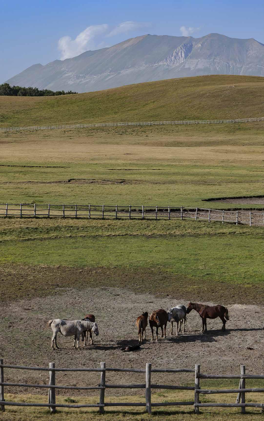
ARQUATA DEL TRONTO 83
› Grazing horses at the Pantani di Accumoli
In the morning after eight o’clock, bulls, cows and horses living in the wild come here to graze and drink water, creating a fairy-tale scenario. That is why we advise you to reach the small lakes early in the morning: setting the alarm a little earlier will allow you to enjoy the spectacle of the animals arriving in orderly colonies. Horses roam freely with their foals, while Chianina cows graze in the distance. In spring and summer, the ponds are enveloped by large expanses of -
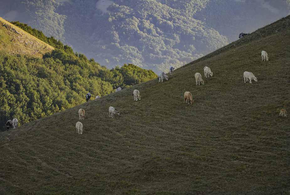
autiful wild orchids.
Another noble frequenter of these huge green spaces is the golden eagle, present in the Sibillini Mountains National Park in several specimens. In the winter months, during breeding season, it is common to see their festive courtship in the sky made of steep swoops and energetic ascents.
 › Grazing cattle nearby the Pantani
84
›Wooden signposts
MEDIUMHIGH MOUNTAIN PATHS
The route, with an altitude ranging from 1541 to 1588 metres, is exposed to the sun. It is therefore recommended to wear hats and protective creams during the summer -
ties, it is also suitable for families with children. For the same reasons, it is also suitable for school excursions into nature. It is accessible all year round and, in the event of snow, lends itself well to the use of snowshoes or cross-country skis, remembering, however, not to cross the wooden fence behind which, in the centre of the valley, are the small lakes.
CURIOSITIES
In order to reactivate the economic fabric compromised by the 2016 earthquake, the Region of Lazio thought of relaunching tourism in the Accumoli Pantani, building a three-storey, 180-square-metre reinforced concrete mountain refuge
the general regulatory plan, transforming the current agricultural area into an area intended for public services, with the expropriation of the land to twenty owners. However, the associations have mobilised in order not to compromise the naturalistic values of the area and are calling for a sustainable future for the area. The last chapter of the affair is still to be written: it remains to be seen whether those opposed to the project will be listened to or whether the construction will go ahead.
 › The Pantani, with Mount Vettore in the background
85 ARQUATA
THE CONTESTED PROJECT
DEL TRONTO
FROM THE MEZZI LITRI REFUGE TO PICCHIO7
INCLUSIVE TOURISM AMIDST BREATHTAKING PANORAMAS
Km: 3,14

HOW TO GET THERE
The route is 3.2 kilometres long, with an altitude difference of 198 metres.

It starts from the Mezzi Litri Refuge, located along the road between Pretare and Forca di Presta. The Refuge is located at the foot of Mount Vettore, in one of the most beautiful natural settings of the Sibillini Mountains, and takes its name from the canal above it. At an altitude of about 1360 metres, it can be reached on foot along the Great Sibillini Ring, at the end of The Reapers’ Path, or else halfway along the eighth stage of the Cammino nelle Terre Mutate. It can be easily reached by car.
Walking time: 1 h Easy
The starting point of this itinerary deserves a little further investigation. The barrier-free bet of the Mezzi Litri refuge was in fact born in the Sibillini mountains in one of the areas most devastated by the 2016 earthquake. Yet there are those who wanted to bet on inclusion and the breaking down of barriers to relaunch tourism
They are Stefano and Elena who, with other members of the Monte Vector association, are managing the refuge: a cottage located in the centre of routes and paths set -
rect access to the main hiking routes, from Lago di Pilato in Castelluccio to The Reapers’ Path, from the Grande Anello dei Sibillini to the Cammino nelle Terre Mutate, and to the most suggestive destinations in the central Apennines.
Stefano and Elena have decided to make the refuge accessible, enabling disabled people to spend a holiday in the mountains. To reach this goal, they have also activated a crowdfunding campaign ‘Alleva la speranza +’, promoted by Enel and Legambiente to relaunch the areas hit by the earthquake. With the sum raised, they have built some access ramps around the building and purchased mobile structures with wide accessibility such as a yurt, the tent of Mongolian origin completely
IL G.A.D.A. IN 4 TAPPE 86 MEDIUMHIGH MOUNTAIN PATHS
15
 › View of Forca di Presta halfway through
allows those who cannot walk to walk along the paths nearby. For the immediate future, the farmhouse plans to install signs in Braille for the blind and visually impaired
Start out walking pointing south from the Mezzi Litri Refuge, along a well-marked path that leads to a valley with a small house. From here, continue another 100 metres until reaching a gorge, through which we cross the valley.
At the end of this part of the route, the path continues downhill until it reaches Fonte Cappella. This historic spring is one of the most characteristic places in the Sibillini Mountains National Park. It is located about 1,200 metres below Forca di Preis above all for hikers.

Continuing along the route, move towards Picchio7. From Fonte Cappella take the road to the left and continue for 300 metres to a crossroads. Take the road to the left for 2 kilometres until we reach a plateau with a dirt road. Proceed to the right along the Costa Gagliola, where there is the path that crosses the Cammino nelle Terre Mutate: that is the panoramic point of Colle del Quarto (1246 m), known by the name of Picchio7, as sighting point number 7 of the Forestry Department.
From here, at the foot of Mountnte Vettore, the view sweeps 360° over the Monte Ceresa complex to the north-east and the Monti della Laga to the south. Monte Ceresa, which reaches 1,494 metres, is a massif in the Umbria-Marches Apennines located on the border between the municipalities of Arquata del Tronto, Montegal-
› Picchio7, with Mount Vettore in the background88 MEDIUMHIGH MOUNTAIN PATHS
straddling the Sibillini Mountains National Park and the Gran Sasso and Monti della Laga National Park.

The Monti della Laga, whose highest peak is Mount Gorzano at 2458 metres, are thetinental Apennines and the highest sandstone relief in the Apennines. They straddle Abruzzo, Lazio and Marche regions.
CURIOSITIES
AN AREA RICH IN RESOURCES
For lovers of zero-kilometre gastronomy, this area of south-western Marche offers excellent quality sheepmeat, pork products, legumes and spelt. Strictly to be combined with dairy marvels such as ricotta and pecorino, which preserve the aromas of the mountain pastures and vary their fragrances according to seasons and fodder. Here, animals live freely and livestock farms respect the environment. The altitude also favours the cultivation of tasty potatoes and the growth of wild herbs, as well as an indigenous wine with the curious name of pecorino (“sheep”) grapes.
› Mezzi Litri Refuge89 ARQUATA DEL TRONTO
FROM FORCA DI PRESTA TO FORCA CANAPINE
THE SIBILLINI HIGH ALTITUDE ITINERARY
Km: 8,23

HOW TO GET THERE
The trail starts from Forca di Presta.
We are on the border between Ascoli Piceno and Perugia provinces, a starting place for many paths. Leave the car along the roadside and begin the rise in the direction of the Rifugio degli Alpini (currently closed). The return can be made along the same route, walking in the opposite direction, or, having left a second vehicle in advance on arrival at Forca Canapine at the Colle le Cese Refuge, we can return with it to Forca di Presta, where the path begins.
Walking time: 2 h 30’ Intermediate
This route from Forca di Presta to Forca Canapine, recognised as one of the hundred most beautiful paths in the Apennines, offers hikers ample panoramic views. Entirely exposed to the sun (in hot weather, do not forget hats, dark glasses, water and protective creams), the
It starts at Forca di Presta, at the foot of Monte Mount Vettore. From here you take the so-called Sentiero per tutti (Path for Everyone) and walk along it for 3.2 kilometres. As the name suggests, the trail is suitable for hikers and families and in winter, in case of snow, it can be walked with snowshoes.
It is an itinerary taking place entirely above 1500 metres (it is important to start with a good supply of water), a characteristic that makes it unique in the Apennines.
mainly on the left side of the ridge formed by the Forciglieta, Pellicciara and Macchialta mountains, separating the Pian Grande and Pian Piccolo (karst plateaus nearby Castelluccio) from the deep Tronto river valley. The environment is predominantly grassland of secondary origin and preserves residual patches of beech

IL G.A.D.A. IN 4 TAPPE 90
16
MEDIUMHIGH MOUNTAIN PATHS
 › Mount Vettore from Mount Macchialta’s slopes
trees. These wide spaces not only report spectacular blooms in the spring months, even of rare species, but are also an ideal hunting ground for birds of prey such as buzzards, kestrels, golden eagles and, in the migration period, the rare cricket falcon. From the ridge, there is an extraordinary view over the Tronto river valley, the Monte Ceresa group, the Monti della Laga and the Monti Gemelli, reaching as far as the Gran Sasso.
At the Belvedere Refuge, take a moment to look at the panorama of the Tronto river valley on a wooden footbridge. There is a viewing platform here, equipped with photographic panels illustrating the landscape, and it is the ideal place for a break.
Continue along the ridge. From here on, we will not encounter any forks or intersections on our path.
Sibillini and Laga mountains, offering scenery that is as impressive as it is suggestive. The pastures, during the warm season, are the ideal habitat for sheep, cows and horexpanses of wild orchids stand out.

The route ends at Forca Canapine at the Colle le Cese refuge, which is awaiting renovation following the earthquake damage.
Forca Canapine rises at an altitude of 1541 metres and is a road pass in the Umbro-Marchigiano Apennines. It falls within the Sibillini Mountains National Park and is divided between the territory of the municipality of Arquata del Tronto, in the province of Ascoli Piceno, and the municipality of Norcia, in the province of Perugia. The elevated position of this natural balcony allows admiring a wide panorama ranging
92 MEDIUMHIGH MOUNTAIN PATHS
› Forca Canapine, with Colle le Cese Refuge
from the Pian Grande di Castelluccio to the west until the Arquatan side of Monte Mount Vettore to the east.
This location is also known to be an important crossroads of paths. In fact, it is part of the European Path E1 route connecting Cape North to Capo Passero in Sicily, one of the eleven long routes in the European path network. The roads to the Forca Canapine mountain pass have been chosen several times as the route of Giro d’Italia.
CURIOSITY
THE ARQUATAN TRANSHUMANCE
The idea promoted by ‘Le terre delle fate’ and other local farms was immediately accepted by Arquata Potest. This is how, in June 2021, -
za Arquatana was born, with the intention of uniting the millenary past of these lands with today’s passion for trekking. The aim is to accompany the transhumance from Pretare to Forca di Presta on foot, all together, telling the story, fascination and hardships of life of those who lead the group, partly alleviating their fatigue, are songs of popular music and concerts of local folk bands.
ARQUATA
93
› Arquatan transhumance
DEL TRONTO
FROM FORCA DI PRESTA TO THE GALLUCCIO MOUNTAIN PASS
THE REAPERS’ PATH
Km: 6,45


HOW TO GET THERE
Take the road heading to the mountain pass of Forca di Presta. About four kilometres before, pass by the Mezzi Litri Refuge going further for about for 300 metres. Here, on your left, there is a large clearing for parking. We are in the Sibillini Mountains, on the border between the provinces of Ascoli Piceno and Perugia, at the point where this itinerary begins. Cross the road, passing next to a brick rainwater collection well: here there is a red-andwhite marker indicating the start of the path, which is quite evident.
Walking time: 2 h Easy
The reapers› path is part of an old route followed during the spring and summer months, following the wheat ripening cycles, from Vallegrascia to the village of Castelluccio di Norcia, located at 1.450 metres. The reapers travelled to harvest the crops as seasonal farm labourers to Umbria and Lazio. It is said they walked at night and worked during the day. They would reach the squares of the villages where they were chosen if they
They moved constantly through valleys, hills and plains, returning at late summer to the area of Castelluccio, where the grain harvest awaited them.
This type of activity was gradually abandoned when mountain farming and pastoralism were no longer
mountains, as we see them today, are nothing more than the result of what man has ‹shaped› for his own needs, and the reapers› path bears a strong echo of this. The reapers› path is passable for most of the year. The walk and orchids accompany our route at several points. The difference of only 274 metres. The minimum altitude is
IL G.A.D.A. IN 4 TAPPE 94
17
MEDIUMHIGH MOUNTAIN PATHS
 ›The path heading to Mount Vettore’s slopes
1263 metres, the maximum 1537 metres. For these reasons, the trail is also particularly suitable for school excursions.
Arriving near the Forca di Presta pass, where the walk starts, one is struck by the grandeur of the Sibillini Mountains. The view then opens onto the plain of Castelluccio di Norcia, one of the largest and most impressive plateaus in Italy. In June and July, the
Walk along the dirt road to reach the pine forest further on. The views of the imposing, rocky south-eastern slope of the Monte Mount Vettore, dominating the landscape, are varied and offer suggestions of the Dolomites. Then enter the forest, where we easily reach Fonte le Càcere, a strategic point to stock up on drinking water.
Along the way, we can admire immense wooded areas covering the surrounding heights and Monte Mount Vettore, which will be our travelling companion until our arrival. . Then leave the forest near Colle Pisciano (1310 m), just above the Galluccio pass. At this point, there is a fork in the road immediately after crossing a bottleneck between two hills. Here we turn right and, in just 15 minutes, reach the end of the itinerary. If you wish to continue, the path goes towards Fonte Graniera, located in the territory of Montegallo. The return can take place along the same route. We point out that about halfway along the route, a couple of passages of about 15 metres
strongly advised against using the route in the event of rain or snow, to avoid possible landslides and/or avalanches. During the drafting of this itinerary, the Monti Sibillini

MEDIUMHIGH MOUNTAIN PATHS 96
› Last stretch of woods before Colle Pisciano
National Park was in the process of creating a route to bypass the landslide and thus cover the route safely. For a section, the Sentiero dei mietitori is also part of the GAS (Grande Anello dei Sibillini), a 120-kilometre hiking itinerary embracing the Sibillini Mountains, and is divided into nine stages. In particular, this itinerary is a section of the stage going from Colle di Montegallo to Forca Canapine (Colle Le Cese refuge).
CURIOSITIES
Halfway along the reapers’ path, the hiker comes across a cavity on the south side of the Vettore, just below the pyramid: it is said to be the cave of the fairies. The theme of these fantastic creatures often returns in the Pretare area. According to a legend, one night, these charming maidens indulged in a long dancing party that went on longer than it should have. The light of dawn surprised them, prompting them to make a hasty escape. The fairies left a sign of their passage on the mountain as a strip of loose soil, full of stones turned over by their furious running: the so called Fairy Road.
ARQUATA DEL TRONTO 97
THE FAIRY CAVE
› Le Cacere’s Spring
FROM COLLE D’ARQUATA TO PIZZO DI SEVO WHERE MARCHE, LAZIO AND ABRUZZO MEET
HOW TO GET THERE
The route starts from Colle d’Arquata, that can be reached by leaving via Salaria at Trisungo, continuing along the SP20 and passing by Faete and Spelonga. Park near the Ramazzotti bridge, which connects Colle with Poggio d’Api.
From the bridge, keeping the left side, follow a short ramp descending between last houses of the village and then climbing up some steps to a steep slope, leading to the church of Santa Maria della Rocca. Once reached this point you enter the heart of an itinerary recommended for experienced hikers.
We would like to point out that there is no telephone line in Colle (Tim is currently the only telephone operator working in this area). We therefore recommend downloading the GPS track before reaching the village. Up to the previous hamlet, Spelonga, the telephone line works regularly.

We are about to start on a very scenic walk along what was once the border between the Kingdom of the Two Sicilies and the Papal States. -
ca, at an altitude of 1108 metres, built on the summit of Monte Rocca.

From here, the path develops between scenic rock ridges cutting the slope, gradually entering the valley of the Vargo ditch, a tributary of the Chiarino river.
Having crossed the stream, continue along a track climbing up into the forest, wide clearings and, after wide bends, joins another path, until reaching the dirt road, whi-
right, we head towards the Enel locks, while not too far away are the remains of the hermitage of Sant’Amico di Avellana, who lived and preached in these mountains in the 10th century.
Proceed uphill a little further to the right, re-entering the
IL G.A.D.A. IN 4 TAPPE 98 MEDIUMHIGH MOUNTAIN PATHS
18
Km: 10,9 Walking time: 4 h
EE - Expert hikers
 › Church of Santa Maria della Rocca
forest in the direction of wide clearings. If necessary, before taking this climb, we can refuel with water at a spring on the right side, continuing along the slightly downhill gravel road, just 50 metres from the start of the rise.
Continue the ascent through the forest along the path to Passo il Chino (1581 m), near Monte Comunitore (1695 m).
with its ridge trail, wonderful views.
Cross a fairytale beech forest, called Cugnolo forest, and once reached the Refuge del-

On one side are Colle Finarolo, Costa Monterotondo and Valle della Corte, on the other the Chiarino Valley and, in the background, the Sibillini and Laga ranges. The ascent to the ridge, with some ups and downs, offers enchanting views. Follow the wide ridge until it joins the north, north-west ridge of the Macera della Morte, at an altitude of 2073 metres (the GPS track for this itinerary does not go up to the summit of the Macera della Morte but passes immediately below it).
Having reached the summit, our invitation is to stop and enjoy the view, as you can see Pizzo di Sevo and, behind on the left, Cima Lepri (2445 m), on the crest of the Monti della Laga. You can now take one of the many farm tracks leading from the Macera to Pizzitello and from there to Pizzo di Sevo.
Below the Macera, an ancient boundary stone marks the present-day border between Marche, Lazio and Abruzzo, kingdoms.
MEDIUMHIGH MOUNTAIN PATHS 100
› The village of Colle
The elders of Colle remember in their youth
far as Passo il Chino, on the wide ridge of the Macera della Morte. Here they sowed oats and, every day, around lunchtime, a mule driven by women would bring up the provisions to feed them.
For more than eight centuries, the Macera della Morte area was the reference point to mark the borders between the Kingdom of Naples and the Papal States, which continued from the Chiarino river to the top of Monteguidone.

In the 16th century, these peaks were beaten by bandits from both states who, in order to escape the hunts of their respective militias, trespassed south or north, depending on their origin. However, this situation of lawlessness was short-lived. In 1580, an agreement was signed whereby soldiers were allowed to trespass up to 12 miles from their own territory to hunt down criminals.
CURIOSITIES
THE PASSAGE OF ANNIBALE
The name Macera delle Morte is said to date back to the time of the commander Hannibal, who passed through with his elephants on his way to Canne, where he defeated Roman troops of Gaius Terentius Varro in 216 BC. During his travels along Via Salaria, the Carthaginian general sacked the Picenum, losing many soldiers and many animals due to the impassable terrain and adverse conditions. They fought along the gorge of the mountain and there were so many victims that their bodies were piled up like stones to form a ‘macera’, a shapeless pile of rocks, which gave the peak its name.
ARQUATA DEL TRONTO 101
› Mount Comunitore’s slopes, with Mount Vettore in the background
FROM FORCA DI PRESTA TO MOUNT VETTORE THE HIGHEST PEAK OF THE SIBILLINI RANGE
Km: 4,93

HOW TO GET THERE
The starting point for this route is Forca di Presta (1550 m), the mountain pass marking the border between Marche and Umbria regions being one of the most characteristic locations in the province of Ascoli. Leave your car at the side of the road, right next to the National Park’s information board. This excursion will allow us to climb Monte Mount Vettore, the highest mountain in Marche, from where it is possible to see Ascoli Piceno, the Adriatic Sea and where, if the sky is particularly clear, the eye can wander as far as the coast of Croatia.
Walking time: 3 h 30’
Due to its gradient and length, this route is suitable for trained people with good mountain hiking experience It is not recommended for children under the age of 1012 years. It is important to stock up on water before the hike, as there are no water supply points along the route. It is also recommended to proceed with caution, using walking sticks to facilitate the ascent and descent. The return is along the same route. Recommended period: April to November, if there is no snow.

Once we set off, the path begins to climb, until, after about 40 minutes and having reached an altitude of 1759 metres, the ridge widens out into a meadow on a slight incline. When the slope becomes steeper, we continue along the path to the left, along a route not very evident at the beginning, then more and more marked. The route now reaches a wide saddle, Stazzo Petrucci, at an altitude of 1922 metres.
Climb up the steep, gravelly point above, where is located the Tito Zilioli cross,in memory of the mountaineer who died there in 1958, until reaching the saddle between Vettoretto, at 2052 metres, and the high ridge on the left. Then turn left, leaving the path which continues on the
IL G.A.D.A. IN 4 TAPPE 102 MEDIUMHIGH MOUNTAIN PATHS
19
 › Hikers at night near the mountain summit
same level, and take the one crossing the entire gravelly slope of the Prato Pulito summit, with increasing gradient, thus reaching the Rifugio Zilioli and the Sella delle Ciaule, at 2240 metres.
Keeping to the right, in about 40 minutes you can reach the summit of Monte Mount Vettore (2478 m). By the way, from Rifugio Zilioli onwards, you walk along the most beautiful and highest crest of the Sibillini, always sharp and accompanied by incomparable views, particularly those of the Castelluccio plateau, lying 1100 metres below: a table of colours changing with seasons.
Once reached the summit of Monte Mount Vettore, the highest one in Marche region, we , so called, probably, to exorcise the name of the Pizzo del Diavolo (Devil’s Lace), the dolomite wall facing it.
climbed it on 4 March 1876 accompanied by a guide and a shepherd. But very old historical documents also tell us that in winter 665 B.C., the Marsi, who had come from Fucino -
ne), and chased by them up to the peaks of the Monte Mount Vettore.
THE LAKE OF PILATE
At the foot of Pizzo del Diavolo (Devil’s Lace), clearly visible from the summit of Monte Mount Vettore, rises the famous Lago di Pilato (1940 m), since the Middle Ages shrouded in an evil and mysterious aura, also known as the ‘lake with glasses’, due to the peculiar shape of its basins.
It is a glacial lake of alpine origin, one of the few in the Apennines.
only by rainfall, but above all by melting snow.

MEDIUMHIGH MOUNTAIN PATHS 104
› The lake of Pilate
If this place has fully entered the popular memory, it is not only because of its beauty. The legends surrounding it are numerous and are lost in the mists of time. The main one is linked to the death of Pontius Pilate, the procurator of Rome in Palestine at the time of Condemned to death under Tiberius, his body was closed in a sack and tied to a cart pulled by two buffaloes, which dragged him for days until the crest of Monte Mount Vettore. From those heights, the animals plunged with the cart into the lake, which has been said to hold the procurator’s corpse ever since and is inhabited by evil creatures and water monsters.
The lake is home to the Marchesoni Chirocephalus, a small endemic crustacean that swims belly up. Its eggs have miraculously survived thousands of drains, guaranteeing the existence of the species to this day. In pagan symbolism, crustaceans were the representation of subterranean transcendent forces: this is why some necromancers considered these crustaceans to be the incarnation of demons.
CURIOSITIES
This historic bivouac is located at an altitude of 2250 metres at Sella delle Ciaule. It enjoys a strategic position for high-altitude hiking, since it is located between the summit of the Redentore and the Monte Mount Vettore itself. The refuge is named after a mountaineer from Ascoli, Tito Zilioli, who
winter outing on the Canalino route with three friends. In 2020, it was completely rebuilt following the damage caused by the 2016 earthquake by the Ascoli Section of CAI (Italian Alpine Club) thanks to numerous donations, including those coming from AVIS Provinciale di Ascoli Piceno.

ARQUATA DEL TRONTO 105
THE TITO ZILIOLI REFUGE
› The bivouac Tito Zilioli’s bivouac and mount Vettore’s summit
4 IN-DEPTH ARTICLE: MYTHS ANE LEGENDS
BETWEEN NATURAL BEAUTY AND ANCESTRAL BELIEFS
A TRIP TO ARQUATA DEL TRONTO IS AN OPPORTUNITY TO GET TO KNOW MOUNTAINS WHOSE LEGENDS ARE ROOTED IN MYTH AND POPULAR BELIEFS. A PLACE OF FANTASTIC SCENERY WHERE TALES PASSED ON OVER THE CENTURIES WILL ACCOMPANY YOU ALONG THESE TRAILS AS AN INTEGRAL PART OF THEIR HISTORY.
A trip to Arquata del Tronto is an opportunity to get to know mountains whose legends are rooted in myth and popular beliefs. A place of fantastic scenery where tales passed on over the centuries will accompany you along these trails as an integral part of their history.

THE LAKE OF PILATE
Natural beauty and ancestral charm: according to legend, the waters of this lake hold the body of Pontius Pilatened to death under Tiberius.
His relics, enclosed in a sack tied to a cart and pulled by two buffaloes, were dragged for days until they reached the Mount Vettore. From those heights, the animals plunged into the lake located below, which has since then populated by demons taking form
the Marchesoni Chirocephalus, an endemic red crustacean which populates its waters.
THE HOLY CRUCIFIX AND THE MIRACULOUS OAK -
tore, currently hosted in the church of Borgo 1, was formerly in the church of San Salvatore di Sotto, in Ascoli Piceno. In 1680, Ascoli laid siege to

106
the city of Arquata. On that occasion, Arquatan fought back the attackers, chasing them until the walls of Ascoli. As a victory trophy, they removed a
would soon become an object of veneration
Once reorganised, the people of Ascoli set out on the trail of their enemies and caught up with them in an area between Favalanciata and Trisungo. During the battle, the simulacrum was placed at the foot of a large oak tree. At this point, something inexplicable happened: the branches of the oak tree bent, almost as if to embrace the Arquatans. The event was interpre-
to remain there, so that the people of Ascoli abandoned the battle and left the sacred icon to the locals.
PRETARE AND THE FAIRY LEGEND
Centuries ago, in the place where Pretare stands today, there was a village -
piness reigned. Destroyed by an enormous landslide caused by the sorceress Sybil, the village came back to life after many years, thanks to the arrival of shepherds who, during the night, were visited by beautiful girls covered in dresses representing nature in all its aspects:
In reality, the nymphs were nothing more than creatures enslaved to Sibyl, with female features and goat’s feet, who, before sunrise, would run away so as not to reveal their real nature. One day, a knight named Guerrin Meschino managed to defeat the Sibyl’s evil powers and freed the fairies from the spell. These fairies became the shepherds’ wives, giving rise to the village of Pretare.

107 ARQUATA DEL TRONTO

TRISUNGO BORGO ARQUATA DEL TRONTO FORCA DI PRESTA 22 21 20 23 24
ARQUATA
G.A.D.A.-BIKE
20. THE G.A.D.A.-BIKE
21. RING OF THE FORCHE
22. RING AT THE FOOT OF THE GIANT
23. THE LAGA BYPASS
ARQUATA DEL TRONTO 109
24. CASTELLUCCIO RIDGES RING DEL TRONTO
G.A.D.A.-BIKE
THE GREAT RING OF ARQUATA BY BIKE
HOW TO GET THERE
The GADA-BIKE starts from the old bridge in Trisungo, on the right bank of the Tronto river. The bridge joins the two banks of the river connecting the Salaria with SP20 road leading to the hamlets of Faete, Spelonga and Colle.
We cross the bridge, continuing along the village street climbing towards Faete, along the road soon joining the SP20. We continue along the SP20 until reaching the entrance to Faete, after about two kilometres. At this point, we enter the heart of the itinerary, a ring of almost 50 kilometres.
For experienced cyclists

At the football pitch, we leave the SP 20 turning left towards Faete, at the wash-house.
After passing the SAE area, we climb up to the Church of Madonna della Neve.Leave the main road and, at the opposite fork, take the mule track to the right leading to the summit of Monte Civita (1049 m).
From the plateau of the Civita, proceed along the main path reaching the fork with a pole, after a couple of hairpin bends in the forest: here we take the winding mule track descending to the right.
After crossing two wide meadows, we arrive in Spelonga. From the main square of the village, take the small road on the right which climbs towards the upper part of the village, until the small Church of Sant’Emidio.Take the mule track in front of the fountain leaning against the left wall of the church and, after a steep climb, there is the convergence of two dirt tracks with another mule track in the middle. Take the latter and arrive at the edge of the chestnut forest, continuing until, after 600 metres, we cross a track climbing to the right. We take it and shortly afterwards meet another track, which we follow, keeping to the right, to the Church of the Madonna dei Santi.From the church, follow the arrows indicating the path to Passo il Chino, climbing up a beaten track to reach a convenient dirt track. Follow it for 4.5

IL G.A.D.A. IN 4 TAPPE 110 G.A.D.A.BIKE
20
Km: 47 Journey time: 5 h 30’
 › Biker at “Picchio7” rest area
kilometres, keeping to the left.
the side of a mountain seeming to be cut by the protruding boulders looming over the road. Please pay particular attention for the next 100 metres as the huge protruding boulders loom over the road. Once passed this point, within 500 metres the gravel road gives way to clay. After a couple of hairpin bends, we come to a turnoff leading to the same point, whether we go right or left.
We continue for another 500 metres to Monte Comunitore (1695 m) from where the descent to Passo il Chino begins. Once reached Passo il Chino, at the fork leave the mulemetres. is rather complex metres.
After about 1.5 kilometres, we turn right onto a track and, after 50 metres, a fountain with drinking water is the last possible break before arriving, in about 2.5 kilometres, at Colle d’Arquata, in front of the Church of San Silvestro.

After passing the church, travel two kilometres along the SP20 in direction of Spelonga, turning left, about one kilometre before arriving in that village, where a scarcely noticeable mule track curves down to the left, right after some temporary stables.
From here, another mule track starts and in 200 metres reaches a fork: we leave it for the path going up on the right, in the direction of Pescara del Tronto.
Pass by a small ruined house and then descend into a clearing. Keep to the right to enter, a little further down, a forest of oak and chestnut trees, in which it is possible to get our bearings by following the horizontal signs. The track returns to level ground for a short distance, and then quickly begins its descent on a steeply sloping gravel road: we recommend
G.A.D.A.BIKE 112
› Arquata and its castle “La Rocca”
you tread it with the utmost care for the next 2 kilometres.
Finally, the track reaches a small bridge over the Tronto river, near the SS4 Salaria road: we turn left towards the SAE area of Pescara del Tronto.
After passing the SAE area, about 500 metres later, leave this road to take, on the right, a dirt road rising steeply towards the SP 129 Tufo-Trisungo road. Once reached the SP 129, continue to the right on an asphalt road until the historic village of Pescara del Tronto..
From here, continue for about three kilometres along the SP 129 in the direction of Arquata, passing by the hamlet of Vezzano before arriving near Villa Papi. Then start rising to
reaches the hill of the repeater. At the next two forks in the road, always keep the left, continuing on ascending, reaching La Botte rest area (with drinking water).
Approximately three kilometres further on, a bend shows a possible diversion to Fonte Cappella on the left: continue uphill along the area (1280 m).
The path ends on the SP89 road before returning, 500 metres further on the left, suddenly back into the forest, leaving the asphalt for a comfortable dirt track along the pine forest over Pretare.
You pass by the Fornace (old kiln) di Pretare, now a resting area.
Continue to descend along Provincial Road SP 89, passing by, in order, the SAE areas of Pretare and Piedilama (both with drinking fountains), Borgo 2 and then Borgo 1, where there is a do-it-yourself bicycle service point with an e-bike recharging column.
From Borgo 1, SP 89 continues downhill for one kilometre until we reach again Trisungo.
CURIOSITIES
THE FORTRESS AND ITS QUEEN
The history of this defensive castle is closely linked to that of Arquata, of which it is the symbol, since it has always been a strategic point. The fortress was built around 1200 for war purposes, in a strategic position overlooking not only the Via Salaria, the road connecting Tyrrhenian to Adriatic Sea, but also the other important junctions of the area.
Popular rumours connect the
Giovanna II d’Angiò, nicknamed “the Mad” because of her restless nature, who lived there from 1420 to 1435, after being crowned queen by Pope Martin V. Other rumours claim instead that King Giacomo di Borbone imprisoned the queen in the castle, after disowning her as his wife, as she was repeatedly guilty of the sin of lust.
A legend tells that Giovanna lured the local shepherds to her room at the top of the highest tower with the promise of a night of pleasure. Their fate, however, depended on the quality of the performance: if
the unfortunate to the wolves. Even today, nearby the fortress, people say it is still possible to hear wails of the sovereign’s ghost who, according to popular belief, roams the rooms of the manor.
ARQUATA DEL TRONTO 113
RING OF THE FORCHE DISCOVERING THE APENNINE PASSES
Km: 20,2

HOW TO GET THERE
The itinerary starts from Forca di Presta, a mountain pass in the Umbria-Marche’s Apennines, located at an altitude of 1550 metres in the Sibillini chain, at the foot of the Mount Vettore, on the border between provinces of Ascoli Piceno and Perugia. Once parked the car, take the gravel road of the Sentiero per tutti, which starts at the foot of Monte Forciglieta and continues for 3.5 kilometres to Monte Pellicciara, at the base of which is the Belvedere Refuge. From here one plunges into the heart of the route. The minimum altitude is 1310 metres, the maximum 1689 metres. Signage is only partially present.
Journey time: 2 h
From the Belvedere Refuge, we start to rising along the southern slope of Monte Macchialta (1751 m), reaching the nearby Colle del Lupo, Colle Cordisciara and, after crossing a section of Macchia Cavaliera, the Colle Le Cese Refuge at Forca Canapine.
From here, we continue along the well-marked trail crossing the ski slopes (Nordica) to the Monti del Sole, , ascending to the refuge (1574 m), descending then at the foot of Monte Cappelletta to the ski lifts.
We take the track going down with a considerable difference in altitude towards Pian Piccolo, passing to the left of a small lake, located at the lowest point of the route (1310 m).
Continue across the entire Pian Piccolo for about 3 kilometres until the Casotto Amati.

At this point, rise up to the left along the path, which shortly afterwards joins the asphalted road near Fonte Nuova. From here, it is easy to reach the starting point of the itinerary, at Forca di Presta.
In winter, this resort was very popular for its ski facilities, considered among the best in Marche region for Alpine and Nordic skiing. The ski resort, currently closed pending the restoration of the access road from Capodacqua, which has not yet reopened following the dama-
IL G.A.D.A. IN 4 TAPPE 114 G.A.D.A.BIKE
21
Intermediate
 › The Belvedere Refuge
ge caused by the earthquake, could count on a 16-kilometre network of ski slopes, as well as a cross-country skiing ring about 10 kilometres long.

We are also in an area particularly rich in mushrooms. There are many different species, from the parasol mushroom, easily found from August to September, to the
St. George’s mushroom is collected, while the porcino is rarer, although we advise enthusiasts to look for it in September, in La Botte area, the aqueduct between Forca di Presta and Arquata del Tronto.
As regards the architecture, in the hamlet of Forca Canapine is located the Church of the Blessed Virgin of Carmel. Erected on a hillock, it belongs to the parish of the nearby village of Capodacqua. Built in the early 1960s by the provincial administration of Ascoli Piceno and inaugurated on 16 July 1965, it is made of travertine blocks. It has a very simple appearance, with a small bell gable. The interior consists of a single rectangular room, with an apse behind the altar, and is illuminated by the light of nine single-lancet windows closed by polychrome stained-glass windows. This characteristic place of worship is the destination of a popular processions organized every three years from the octagonal Temple in Capodacqua.
G.A.D.A.BIKE 116
› The Pian Piccolo
A BIT OF ETYMOLOGY
For lovers of place names, Forca di Presta derives from the juxtaposition of two terms: forca, meaning mountain pass, and Presta, which for some historians can be traced back to the Sabine goddess Praestitia. Others trace the meaning of this word back to the Latin verb praestare, meaning to stand higher. Still on the subject of etymology, the name Forca Canapine also has curious origins. In fact, it seems to derive from the combination of the terms forca (mountain pass), and canapine, in reference to the cultivation and harvesting of hemp (canapa),an agricultural activity practised in the past
CURIOSITIES
THE ITALIA PATH
Considered the most beautiful trekking route in the world, it crosses our entire country with its 7000 km . Following the directives of the CAI section of Ascoli Piceno, Arquata Potest has succeeded in having part of the route also passing through the Arquatan territory, mostly along restored traditional paths. Stage N02 goes from Accumoli to Colle d’Arquata. Stage N01 from Colle d’Arquata to San Martino di Acquasanta through the Macera della Morte.

ARQUATA DEL TRONTO 117
› Horses in the wild along the path
RING AT THE FOOT OF THE GIANT ON THE SLOPES OF MONTE MOUNT VETTORE
Km: 22,3 Journey time: 2 h 15’ Intermediate


HOW TO GET THERE
Park your car at the SAE area of Borgo1 in Arquata del Tronto, also served by a bar and a grocery shop. Begin this cycling itinerary by passing the football pitch turning the left at the crossroad. Continue along the road that passing by Borgo di Arquata, which lies along the old Via Salaria road (SP 129). After about 500 metres, at the crossroads, turn left again and then immediately right, rising in the direction of Camartina, a small hamlet of the municipality of Arquata. From here, we enter the heart of this trail.
The ring at the foot of the Giant takes its name from Monte Mount Vettore, the highest peak of Sibillini Mountains as well as Marche region. It is an itinerary of intermediate landscapes and characterised by this peak dominating theness of the stream running through it, we proceed straight ahead, keeping the ditch on our left. The asphalt soon gives way to dirt road. A few hundred metres further on, at
After about one kilometre, there are two more forks: turn left again, climbing up the road.
The climb continues until reaching, after a couple of hairpin bends, a pleasant picnic area, ideal for rest, nearby La Botte spring (located a short distance away, about 30 metres from the wooden signpost) at an altitude of 1,000 metres. This spring supplied Arquata with water before the construction of the Pescara aqueduct. The itinerary keeps on climbing up with a slight incline towards the ruins of the ancient Casa del Conte Gallo (Count Gallo›s house) and then comes to a fork. Continue
IL G.A.D.A. IN 4 TAPPE 118 G.A.D.A.BIKE
22
 › Entrance to the forest at the foot of Mount Vettore
straight ahead, approaching the scenic slopes of Mount Vettore (2478 m).
Approximately 6 kilometres from the starting point, at an altitude of 1220 metres, a sharp bend shows on the left the fork in direction of Fonte Cappella, another possible stop to refuel with water. Alternatively, continue to the right along the track to Colle del Quarto, a place also known as Picchio 7 (1280 m).
At this point, reach the SP 89 road by turning left. After the second hairpin bend, on the left, is located the Mezzi Litri Refuge. Further, after another bend, on the rightside, there is indication of the access to the path: a small wooden pole and a rainwater collection well located on the right side of the road, about 4 kilometres before Forca di Presta mountain pass. Opposite the well is a large clearing with a wonderful panoramic view of the Tronto river valley and the Laga mountain chain.
This is the starting point of an itinerary that is part of the GAS (Grande Anello dei Sibillini), which is as easy as it is spectacular: it winds along the foot of Monte Mount Vettore and runs mainly through a wood with no difference in altitude. The views of the imposing and rocky south-eastern slope of the Vettore, which looms over the Pineta, are varied and offer dolomitic suggestions.
Caution should be exercised, however: due to a landslide caused by the 2016 earthquake,vise against tackling the route during rainy periods or when there is a risk of avalanches. During the drafting of this itinerary, the Monti Sibillini National Park was in the process of creating a route to bypass the landslide and thus cover the route safely. The beginning of the path is slightly breached: follow the markers and, once in the pine
Shortly after entering the forest is located Fonte le Càcere (driking water).
G.A.D.A.BIKE 120
› Biker at Colle del Quarto
Right after Monte Mount Vettore slopes, the path remains easily accessible and identi-

forest near Colle Pisciano (1310 m), just above the Galluccio pass. At this point, immediately after crossing a bottleneck between two hills, we come to a fork in the road. Turn right and descend for about a kilometre, until crossing the paved provincial road. Follow the signs indicating the descent down the picturesque Valle Stretta (Narrow Valley). Beware of the hairpin bends and the considerable gradient because it is possible to encounter hikers proceeding in the opposite direction. Further on, the difference in altitude decreases. We pass some vegetable gardens and reach Pretare. From here, continue along the SP 89 road, crossing Piedilama and the
SAE Borgo1 area, where there is a MTB emergency service point with an e-bike recharging station.
CURIOSITY
DOCTORS AND MEDICINE IN ARQUATA
medicine, was born in Pretare. Professor of embryology and physiology at the University of Bologna, his fame is linked to embryogenesis and peripheral nerve endings,
The Civil Hospital Giuseppe Papi, decommissioned already before the 2016 earthquake, and the modern Health Centre share the same location and aim of making health services accessible to everybody. These two facilities were built in different times and in different ways: in 1921 the former one, thanks to a lottery, and in 2020 the latter, thanks to post-earthquake donations, including that one of Avis Provinciale di Ascoli Piceno.
ARQUATA DEL TRONTO 121
› Stretch of woods before Colle Pisciano
THE LAGA BYPASS DISCOVERING THE SANDSTONE MASSIF

Km: 23,1
HOW TO GET THERE
The itinerary starts in Trisungo and is practicable both on foot and by mountain bike, but

between Trisungo and Spelonga are different. If you go by foot, from Trisungo you take the old conthen to Spelonga, as shown in the GPS track. Otherwise, by mountain bike, from Trisungo, ascend to Spelonga along the provincial road SP 20.
Pay particular attention by bike on the way back to a 500-metre stretch from Passo il Chino to Trisungo, which is badly deteriorated.
Journey time: 3 h
We start our mountain bike itinerary from the church of Sant’Emidio, in Spelonga, taking the mule track in front of the fountain leaning against the left wall of the church. After a short ten-minute stretch, near the aqueduct reservoir (Le Schiarezze), we meet the convergence of two dirt tracks with a mule track in the middle. Continue along the latter, which is wide and paved with large stones. Cross a
the edge of the large chestnut forest (Le Macchie) marked by another ditch, usually dry (Portella ditch). Continue pedalling through the forest, where the mule track descends slightly until, after 500-600 metres, we cross a track climbing to the right. Take it and, shortly after, meet another one, which has to be followed to the right, until reaching the Church of the Madonna dei Santi (1128 m), a jewel set in the quiet of centuries-old chestnut groves. Completely immersed in nature, amidst pastures and woods, this jewel of the municipality is currently awaiting renovation after the damage caused by the 2016 earthquake.
Continue following the directional arrows to Passo il Chino, rising a beaten track which after about 15 minutes joins a junction with a spring, crossing a gravel road. Here it is
IL G.A.D.A. IN 4 TAPPE 122 G.A.D.A.BIKE
23
MTB tour for experts
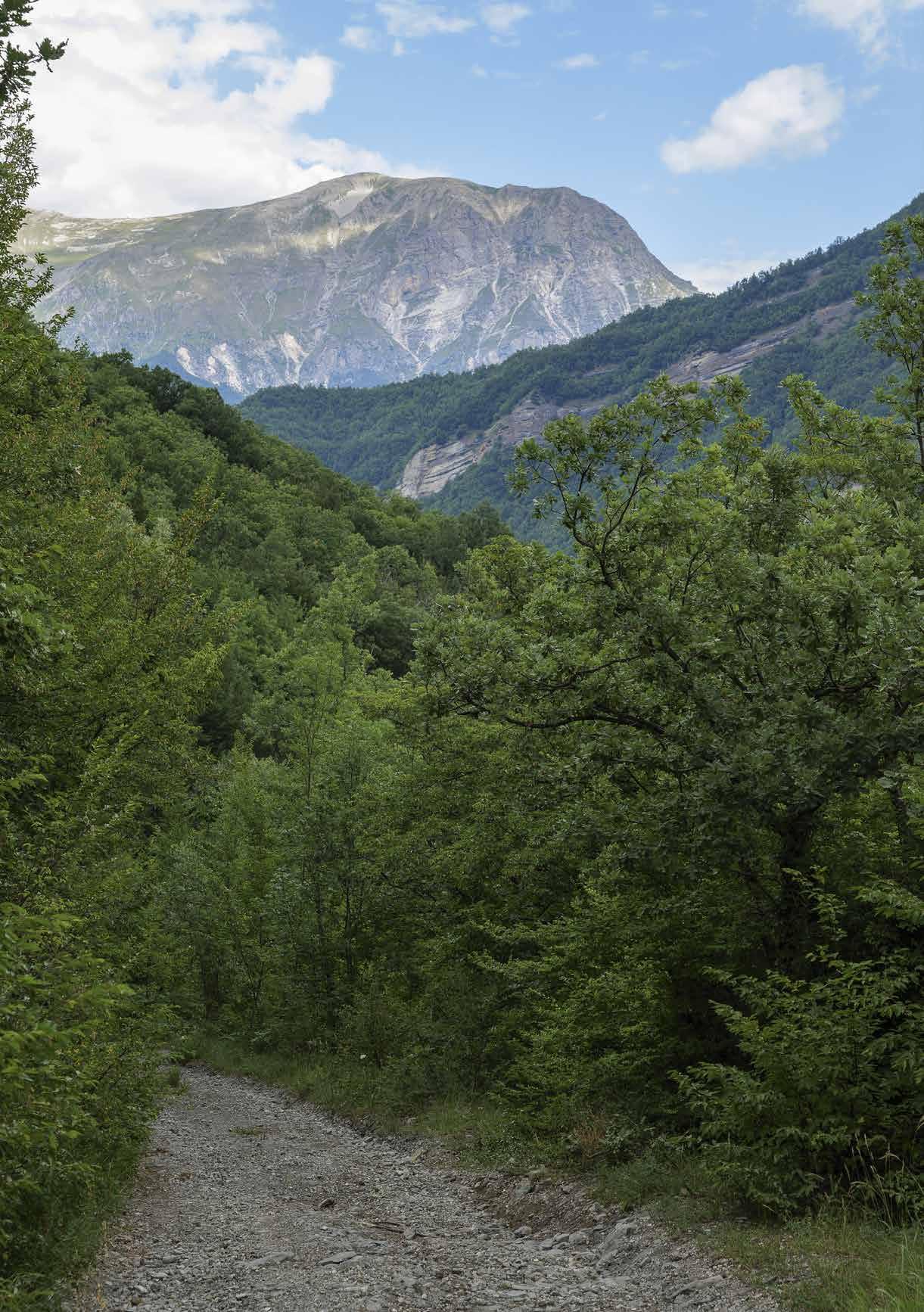 › Mount Vettore from the path
necessary to continue on the left, slowly climbing for about 4.5 kilometres with panoramic views of Monte Mount Vettore accompanying the whole way.

Reach a car park on the left and a small picnic area: from here, continue alongside the Vena de lu Pujie, to the left: be very careful for the next 100 metres as large protruding boulders loom over the road and sometimes a few stones roll down into the valley. Once past the coast, within 500 metres the gravel road is replaced by beaten earth: after two hairpin bends, we come to a diversion leading to the same point, whether we go right or left.
Another 500 metres and we reach Monte Comunitore: the highest point of the route, at an altitude of 1695 metres. From here begins the one-kilometre descent to Passo il
ach a second fork with another signpost, where we turn left. We continue along this dirt road which, after 50 metres, enters the forest: a feature which accompanies the entire descent to Trisungo.
From here, we begin about 8.5 kilometres of descent, which can be divided into three
rest.
After about 4 kilometres, the vegetation changes and the road conditions worsen due to the increased gradient. Particularly in a 500-metre stretch where the watercourse has invaded the roadway, making part of it unusable. Great care must be taken here, as the earth and rock track is hardly passable. The advice is to get off the bike and continue on foot.
The last part, which is less steep, opens up with spectacular views of the Tronto river Valley the valley. Once reached the Costa Farneto with its chestnut groves, the mule track of
G.A.D.A.BIKE 124
-
-
› Beechwood at altitude before descending to Trisungo
beaten earth and rock gets much better, becoming practically carriageable until the arrival back to Trisungo.
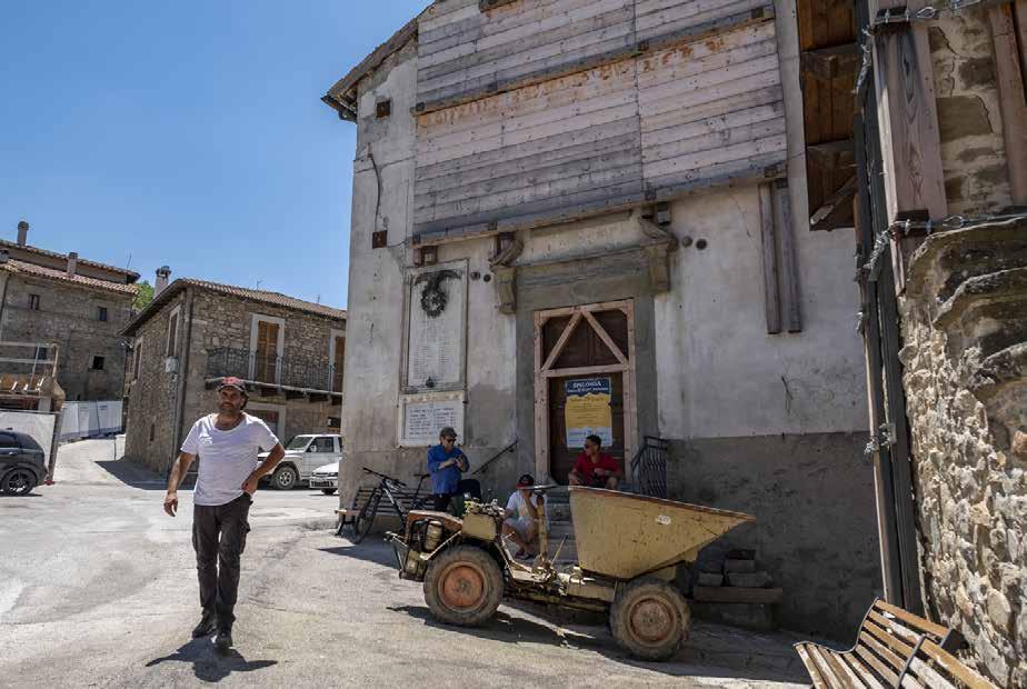
As we descend into the valley, we observe the typical stepped morphology characterising the landscape of these areas. With their ‘sawtooth’ course, the ridged slopes highlight the result of the erosive action of atmospheric agents over the millennia. The origin and geological nature of the Monti della Laga and Monte Ceresa is the same: sandstone. The two areas are very similar to each other, while the adjacent Sibillini Mountains are mainly composed of limestone.
CURIOSITY
THE MOUNTAINEER’S BREAD
For the people of Laga Mountains, the chestnut tree represents not only a source of income, but also a strong cultural identity trait. This majestic tree species is typical of the local forest landscape. Its spread is linked both to favourable environmental conditions and to its multiple uses by man. For this reason, hikers are asked not to pick chestnuts when walking the routes in autumn, as the precious ‘bread of the mountaineer’ is a source of income for those who are taking care of chestnut groves throughout the year.
ARQUATA DEL TRONTO 125
› Spelonga, Church of Sant’Agata
CASTELLUCCIO RIDGES RING THE WONDER
OF BLOOMING
Km: 34,9

HOW TO GET THERE
The starting point of this itinerary is Forca di Presta, a mountain pass in the Umbria-Marche’s Apennines, located at an altitude of 1550 metres. The pass is easily reacheable by following the road from SS4 Salaria, at the height of the hamlet of Trisungo, passing by the villages of Borgo, Piedilama and Pretare. After about 6 kilometres, take the crossroad to the left reaching then Forca di Presta pass, with a wonderful view of the Tronto river valley.
Journey time: 4 h
Forca di Presta in direction of Castelluccio, immediately turn left onto the canal running alongside it towards Pian Piccolo. Be careful, as this is a descent about 2 kilometres long with a considerable gradient. Once reached Pian Piccolo, turn in the direction of a farmhouse following the dirt road on the right, running alongside the asphalt road. Then cross it further on.
When reached the crossroad, take the track to the right, which passes at the foot of Castelluccio and goes around the village at the base of the right side to continue towards Pian Perduto. Cross the tarmac road, passing by to continue along the Val di Cànatra. Follow the track until the Sentiero Italia, which goes back to Castelluccio.
Then take the easy dirt road up towards the cemetery (Sentiero Italia + E1), reaching the foot of Monte Veletta, and continue up then to the paragliding launching point at the base of Poggio di Croce (1614 m), the highest point on the itinerary.
At the crossroads turn left, do not proceed towards Monte delle Rose, but rather go along Sentiero Italia, descending through Montagna Fusconi, Colle Tosto, Monte Vetica and Monte Ventosola, heading to Rifugio Perugia at Forca Canapine.

IL G.A.D.A. IN 4 TAPPE 126 G.A.D.A.BIKE
24
MTB tour for experts
 › Mount Vettore’s quake fault and Eagle Rock
From here, a pleasant up and down along the GAS (Grande Anello dei Sibillini) connects Forca Canapine to Forca di Presta.
To witness the famous blooming of Castelluccio, it is possible to plan a mountain bike excursion in the period from the end of May to mid-July. During these months, the chromatic monotony of the pastureland on the plateau is broken by a mosaic of colours, with variations of tones ranging from red to yellow ochre.

cise day to admire this wonderful spectacle. Each year everything is depending on weather conditions of the full season.
Buttercups, poppies, daffodils, gentians, asphodels, violets eugeniae, clovers, sorrels, violets.
months are numerous (the plains are nothing more than the bottom of a large basin which has progressively dried up and is partly eaten away by the karstic swallowhole at the beginning of the Mergani ditch).
As you cycle along the path, your eye is continually stimulated by colours.
path in order to immerse oneself in its colourful spectacle of lights, colours and scents.
at the melting of the snows. in the area, developing at different times. This allows the constantly changing colours of the plots of land.
G.A.D.A.BIKE 128
-
-
› View of Castelluccio and Italy-shaped forest
thtaking harmony of colours, with multicoloured stripes ranging from bright green to soft purple.
The Pian Perduto and part of the high and low hills are also sown from year to year, as the snow here generally melts later. The rearea.

It is possible to go horse riding on the plateau, while, for those who love photography,
time to visit Pian Grande.
CURIOSITIES
FORCA DI PRESTA, CROSSROADS OF PATHS
Lying in the Sibillini mountains, at the foot of Mount Vettore, Forca di Presta divides the territory of the province of Ascoli Piceno from that of Perugia. It is one of the most characteristic mountain places in the area, as well as one of the access points to the Piani di Castelluccio (Castelluccio Plains). Here, it is possible to closely observe the Arquatan slope of Mount Vettore, which rises almost vertically, and the roughness of its rocky aspect. The locality is crossed by the Cammino nelle Terre Mutate and Sentiero E1 and is the starting point towards Forca Canapine, Mount Vettore and Pilato’s Lake.
ARQUATA DEL TRONTO 129 -
› Trail section into the lentil fields

IL G.A.D.A. IN 4 TAPPE 130
ARQUATA DEL TRONTO
TYPICAL DISHES
1. OMELETTE WITH MINT A MUST FOR EASTER BREAKFAST
2. THE “CORATELLA”: LAMB OFFAL ARQUATAN STYLE THE FIFTH QUARTER OF EASTER
3. THE FAIRY SOUP (ZUPPA DELLE FATE) AUGUST THE 15TH AT THE FOOT OF MONTE VETTORE
4. POLENTA CARBONARA-STYLE THE RICH AND TASTY WOODCUTTER’S PLATE
5. TIMBALLO DI CRISPELLE THE FESTIVE DISH
6. LEPANTO-STYLE MEZZE MANICHE
7. I LUNGHETTI: THE “LENGTIES” THE TRADITION OF MAUNDY THURSDAY
8. THE CAZZIMPERO PORK, PLUMS AND PINK APPLES
9. THE ‘NGRECCIATA ARQUATAN SPRING RECIPE
10. “TRE-SEI-NOVE”: THREE-SIX-NINE THE DELICIOUS CREAM OF PRETARE
11. NOCIATA AND THE HOUSE SMELLS OF LAUREL
12. CHESTNUT RAVIOLI THE TYPICAL CARNIVAL SWEET
ARQUATA DEL TRONTO 131
OMELETTE WITH MINT A MUST FOR EASTER BREAKFAST

DOSE FOR
4 people
DIFFICULTY
Easy PREPARATION
15 minutes
COOKING
10 minutes
INGREDIENTS
Eggs 6
Spearmint 20 g
Salt as required
Oil as required
Traditionally, this dish is prepared for Easter breakfast, accompanied by salami, cheese pizza and hot coratella. The eggs used to make Omelette with mint are blessed the night before by the village priest.
1. Harvest the mint the day before, remove the tougher stems and soak it in water overnight, keeping it in the
2. Pour the eggs into a bowl, salt and beat them well with a fork. Add the chopped mint, which should be so much that the mixture is a nice bright green..
3. Put a couple of tablespoons of oil to heat in a non-sticky and not-very-large frying pan, because the omelette must come out quite high. Pour in the eggs with the mint. Cook well on one side, then on the other. Serve warm or even cold, cut into slices or cubes.
IL G.A.D.A. IN 4 TAPPE 132 COOKBOOK
1 1
THE “CORATELLA”: LAMB OFFAL ARQUATAN STYLE
THE FIFTH QUARTER OF EASTER
It is a typical Easter dish from Arquata, made with lamb ofeverything that is not part of the animal’s noble meat cuts.

1. Preparation begins by cleaning the offal and cutting it into pieces. In a large frying pan, sauté the chopped onion in olive oil and the garlic clove. Once softened, remove from the pan and keep aside
2. In the oil in which the onion and garlic were sautéed, add the lungs: cook for about 5 minutes, stirring often. Cover with a lid and cook for 15 minutes over low heat, checking occasionally and adding water if necessary. When the lungs have lost most of their volume, add the heart, bay leaf and rosemary and deglaze with wine. Taste the meat: if it is not tender enough continue cooking.When ready, add the liver, kidneys and spleen and cook for a further 5 minutes on a medium heat without a lid
3. When cooked, add the onion and garlic set aside to the offal. Leave on the heat for a few more minutes and serve the offal piping hot.
DOSE FOR 4 people
DIFFICULTY Medium
PREPARATION 10 minutes
COOKING 45 minutes
INGREDIENTS
Lamb offal (heart, lungs, spleen, kidney, liver) 1 kg
Garlic clove 1
Onions 1
White wine 1 glass
Bay leaves 2
Rosemary sprig 1
Salt and pepper as required Oil as required
ARQUATA DEL TRONTO 133
2
THE FAIRY SOUP (ZUPPA DELLE FATE)
AUGUST THE 15TH AT THE FOOT OF MONTE VETTORE
DOSE FOR
4 people
DIFFICULTY
Medium
PREPARATION
40 minutes
COOKING
60 minutes
INGREDIENTS
White mountain potatoes 800 g Eggs 2

FOR THE BROTHERS
Beef 300 g
Wild mountain spinach 200 g
Carrot 1
Celery 1
Onion 1
Peanut oil as required
Wild spinach, a true mountain rarity, is the main ingredient of the Fairy Soup. A typical dish of the poor cuisine of Arquata, it is one of the main courses of the festival organised during the Descent of the Fairies, on 15 and 16 August every year. A historical re-enactment in costume that has been celebrated since the war, every three years, in Pretare, a characteristic hamlet of Arquata del Tronto, at the foot of Monte Vettore.
1.toes, forming diamond shapes about half the size of ordinary ones. Then fry them in boiling oil.
2. Prepare a beef stock by combining carrot, onion and celery with the meat. Once ready, cook the chopped wild spinach in it. This is a vegetable which grows wild at high altitudes for a fortnight in June. Alternatively, you can replace it with ordinary spinach.
3. Pour the broth into the dish and add the dumplings.
IL G.A.D.A. IN 4 TAPPE 134 COOKBOOK
3
POLENTA CARBONARA-STYLE THE RICH AND TASTY WOODCUTTER’S PLATE
A very protein-rich recipe typical of the hamlet of Capodacqua. It was prepared by the charcoal burners, the men who worked for days in wood cutting for turning it into charcoal.
1. Dice the bacon and brown it over low heat. Sprinkle theta over low heat, stirring constantly, for about an hour. Once ready, tip it onto a wooden cutting board. Level its surface with a wooden spoon moistened with water: the thickness should be a few centimetres.
2. Then cover the polenta with a tea towel and leave it to cool.Once cold, use a kitchen string to cut it into slices.Grease an oven dish, arrange a layer of polenta on the bottom of it. Season with a few spoonfuls of guanciale and sprinkle with pecorino cheese and a pinch of pepper.

3. Place the polenta in a preheated oven at 190 °C for about ten minutes and serve piping hot.
DOSE FOR 4 people
DIFFICULTY
EASY
PREPARATION
20 minutes
COOKING
70 minutes
INGREDIENTS
Guanciale 250 g
Pecorino cheese q.b.
Oil as required
Salt as required Pepper as required
ARQUATA DEL TRONTO 135 4
TIMBALLO DI CRESPELLE THE FESTIVE DISH

DOSE FOR 8 people
DIFFICULTY Easy PREPARATION
60 minutes
COTTURA
30 minutes
INGREDIENTS FOR THE CREPES
Eggs 15
Flour 400 g
Water 0.5 l
Oil 100 ml
Salt as required FOR SEASONING
Beef 0.5 kg
Pork 0.5 kg
Chicken 200 g
Dried porcini mushrooms 20 g
Parmesan cheese 150 g
Peeled tomatoes 1 kg
Mozzarelle 4
Garlic 1 clove
Onion 1
Celery 1
Carrot 1
White wine 100 ml
Milk as required
This dish is mainly prepared on festive days, especially for Christmas and New Year’s lunches.
1. For the crispelle (a kind of thin crepes), mix all ingredients to obtain a batter of medium consistency and let it rest in the fridge for thirty minutes. Using a ladle, pour the batter onto a non-sticky frying pan with a diameter of about 25 cm and a little oil to prevent the mixture from sticking to the bottom. Cook the crispelle on both sides.
2. For the seasoning, prepare a sauté with the herbs, add the coarsely chopped meat, and deglaze with white wine. Meanwhile, prepare the sauce with tomatoes and onion. When cooked, pass the meat through the mincer and mix the minced meat with the sauce. Soak the dried mushrooms in warm water and sauté them with garlic and a little oil.
3. In a buttered baking dish, alternate one layer of crispelle, one of white sauce with chopped mozzarella, mushrooms and parmesan, another layer of crispelle and one with the sauce and minced meat. Continue until the pan is full. Bake in the oven at 180° for about 30 minutes.
IL G.A.D.A. IN 4 TAPPE 136 COOKBOOK
5
LEPANTO-STYLE MEZZE MANICHE
Every three years, the hamlet of Spelonga di Arquata del Tronto hosts the Festa Bella, a unique historical re-enactment celebrating the participation of 150 people in the Battle of Lepanto on 7 October 1571: the greatest naval battle in history, between Christians and Muslims.This event gave rise to a special menu, made up of typical products and historical dishes including, precisely, Mezze maniche alla Lepanto (Lepanto-style mezze maniche), which have rightfully become part of the Circuit of Typical Piceno Cuisines and are usually prepared during August feasts in Spelonga.
1. Put a pot with salted water on the stove. In a saucepan, fry the onion with a little oil and add the chopped sausage. Halfway through cooking, add the streaky bacon, cut into matchsticks. Cook the porcini mushrooms with oil and garlic in a separate pan and add them later to the sausage and bacon.
2. When the pot of water boils, cook the mezze maniche, drain them while still al dente and toss them in the pan with the sauce. Add a little cooking water and grate the pecorino cheese on top.
DOSE FOR 4 people
DIFFICULTY Easy
PREPARATION 20 MINUTES
COOKING 30 minutes
INGREDIENTS
Mezze maniche 400 g
Sausage 200 g
Bacon 150 g

Dried porcini mushrooms 80 g Onion 1
Garlic 1 clove
Pecorino cheese as required
Oil as required Salt as required
ARQUATA DEL TRONTO 137 6
I LUNGHETTI: THE “LENGTIES” THE TRADITION OF MAUNDY THURSDAY
DOSE FOR 4 people
DIFFICULTY
Medium
PREPARATION
20 minutes
COOKING
40 minutes
INGREDIENTS
Eggs 2
Water as required
Flour 400 g
FOR THE SAUCE
Lamb stew (broken shoulder)
Tomato puree
Red wine one glass
Odours as required
Olive oil as required
Salt as required
This recipe, typical of Arquata, was prepared for lunch on on the table on their return from school and start the gastronomic celebrations associated with the Carnival.

1. The lunghetti are made by mixing beaten eggs with a long snakes and from these cut small cylinders about 4 centimetres long.
2. Fry the meat with the herbs and oil. Deglaze with red wine and add the tomato puree and a glass of water.
sauce for a long time, adding more water if necessary.
3. Boil a pot of salted water and cook the lunghetti. Drain them while still very al dente and add them to the sauce from which the meat and herbs have been removed
lunghetti are served with the stew and a generous sprinkling of pecorino cheese.
IL G.A.D.A. IN 4 TAPPE 138 COOKBOOK
7
THE CAZZIMPERO PORK, PLUMS AND PINK APPLES
This recipe is a very tasty stew with apples and prunes. Traditionally, it was prepared in Arquata on the day the pig was slaughtered. It was a convivial occasion attended by several people, and Cazzimpero was precisely the typical dish for celebrating this ritual all together.The pink apples were those typical of the Sibillini Mountains, cooked with the whole peel.
1. To prepare the Cazzimpero, brown the pork in a non-sticky frying pan with all the herbs, deglaze with white wine, add the diced apples and prunes cut in half. Cover with a lid and continue to simmer for about 50 minutes.

2. . After the time has elapsed, you will have a soft meat with a very tasty cooking juices. Serve the Cazzimpero hot, accompanying it with good home-made bread. A variation of the traditional recipe involves cooking potatoes along with pork and fruit.
DOSE FOR 4 people
DIFFICULTY
Medium
PREPARATION 10 min
COOKING
60 min
INGREDIENTS
Pork meat 1 kg
Celery 1 rib
Onion 1
Carrot 1
Apples 1 kg
Dried prunes 0.5 kg
Oil as required
Rosemary sprig 1
Garlic cloves
3
Sage 2 leaves
Laurel 2 leaves
White wine 200 ml
Salt and pepper as required
ARQUATA DEL TRONTO 139
8
THE ‘NGRECCIATA ARQUATAN SPRING RECIPE
DOSE FOR 4 people
DIFFICULTY Easy PREPARATION 20 minutes
COOKING
35 MINUTES
INGREDIENTS
Swiss chard 1 bunch
Artichokes 6
Broad beans 1kg
Peas 0.5 kg
Onion 1
Oil as required
Salt as required
Spearmint, q.b
The ‘ngrecciata is a poor dish of peasant origin, but with a full, In central Italian regions, this dish is also known as Vignarola.
1. First prepare the vegetables: clean, wash and chop the chard, clean the artichokes by removing the outer, tough leaves and cutting them into thin slices. Leave them in water and lemon until cooked to prevent them from darkening. Shell the broad beans and fresh peas

2. In a high-sided pan, sauté the chopped onion with oil. Once browned, add the vegetables, add salt and cook
add a little hot water. Now lower the heat to low level and let the vegetables cook for about thirty minutes, stirring often. At the end of the cooking time, add a little mint.To give it
can also be browned and added to the vegetables.
IL G.A.D.A. IN 4 TAPPE 140 COOKBOOK
9
“TRE-SEI-NOVE”:
THREE-SIX-NINE THE DELICIOUS CREAM OF PRETARE
Gastronomy is one of the most characteristic aspects of the area. The mountains have always offered genuine raw materials. The inhabitants of Arquata, combining them, have created a rich and varied culinary tradition. Sitting
of times gone by.
So it is with this recipe, a typical cream from the hamlet of Pretare. The original name of this cake derives from the quantities of ingredients used to prepare it: three spoons
For apprentice chefs, there is nothing easier than approaching the kitchen with this recipe, which is excellent for
Tre-sei-nove with delicious berries and a glass of vino cotto, produced in the surrounding areas.
1. Mix the ingredients well, place them in a saucepan with the milk and boil over low heat. When the mixture is well thickened, the cream is ready.
DOSE FOR 4 people
DIFFICULTY Medium
PREPARATION 10 minutes
COOKING 10 minutes
INGREDIENTS
Cocoa 3 tablespoons

Flour 6 tablespoons
Sugar 9 tablespoons
Milk 1 l
ARQUATA DEL TRONTO 141 10
NOCIATA AND THE HOUSE SMELLS OF LAUREL
A typical Christmas dessert from Arquata, it is usually eaand letting them perfume the room.
1. chopped nuts. For those who prefer to have a harder and more consistent result, it is suggested to melt two ounces of sugar in addition to the honey

2. Stir the mixture often with a wooden spoon until the honey browns. This is essential, otherwise when you go to lay the mixture on the wet wooden board, it will
olive oil, so that the nuts do not stick. Roll out the honey while still warm with a wet rolling pin until the dough is one centimetre thick.
3. After resting for a few minutes, cut, again starting from the outside. It is garnished with well washed and dried bay leaves. In a cool place, the nociata will keep well for seven to ten days.
IL G.A.D.A. IN 4 TAPPE 142 COOKBOOK
DOSE FOR 4 people DIFFICULTY Easy PREPARATION 20
COOKING 30
minutes
minutes INGREDIENTS Honey 1 kg
11
Walnuts 1 kg Laurel 20-30 leaves
CHESTNUT RAVIOLI THE TYPICAL CARNIVAL SWEET
In Arquata, Carnival is not Carnival without sweet chestnut ravioli, a delicacy which has accompanied this time of the year for generations. There are numerous chestnut groves in the area: that is why the so-called ‘bread of mountaineers’ is the main ingredient of this winter dessert

1. obtained. Boil the chestnuts after cutting them andamy, but at the same time the larger pieces will give cocoa, coffee, anisette and sugar.
2. After a resting time of 30 minutes, roll out the dough on a pastry board until it is a few millimetres thick,gh in a row, spacing them out and close them with the well. Finally, using a pastry cutter, give the ravioli the shape of a semicircle and brush them with beaten egg.
3. Fry the chestnut ravioli in plenty of peanut oil and sprinkle with icing sugar before serving.
DOSE FOR 4 people
DIFFICULTY Medium
PREPARATION 90 minutes
COOKING 10 minutes
INGREDIENTS FOR THE PUFF PASTRY
Eggs 4
Oil as required
White wine 50 ml FOR THE FILLING
Chestnuts 500 g
Bitter cocoa 100 g
Coffee 3 cups
Anisette as required
Sugar 30-40 g
Icing sugar as required
Peanut oil as required
ARQUATA DEL TRONTO 143 12

IL G.A.D.A. IN 4 TAPPE 144
ARQUATA DEL TRONTO
LOCAL BUSINESSES
1. LE TERRE DELLE FATE” (THE FAIRY LANDS)
THE ORGANIC FARM AT THE FOOT OF MONTE VETTORE
2. PETRUCCI BUTCHER SHOP
LOCAL MEAT AND PRESERVATIVE-FREE BUTCHERY
3. OSTERIA DEL CASTELLO (THE CASTLE TAVERN)
AMONG THE BEST IN LE MARCHE
4. ANTONIO FILOTEI BUTCHER SHOP
QUALITY ZERO KILOMETRES’ MEAT
5. RIFUGIO DEGLI ALPINI (THE ALPINE REFUGE)
GINO AND BARBARA STARTING AGAIN FROM PRETARE
6. MEZZI LITRI REFUGE
STEFANO AND ELENA’S INCLUSIVE TOURISM
7. IL PONTICELLO (THE LITTLE BRIDGE)
PIZZA WITH LOCAL FLOURS, PORCINI MUSHROOMS AND TRUFFLES
8. AGRIARQUATA WINERY
PECORINO WINE AND LOCAL JAMS
ARQUATA DEL TRONTO 145
LE TERRE DELLE FATE (THE FAIRY LANDS)
THE ORGANIC FARM AT THE FOOT OF MONTE VETTORE
ADDRESS
Organic Farm
Le Terre delle Fate
Frazione Pretare 4b
63096 Arquata del Tronto (AP)
CONTACTS
Phone: 3203452403
Web: https://leterredellefate.it
SPECIALITIES
mountain lentils, sultan chickpeas and borlotti beans, pasta, potatoes, nuts and chestnuts
Love for the land, quality of products and respect for the environment: these are the fundamentals of Le Terre delle Fate farm, located over 1000 metres above sea level in the hamlet of Pretare.
The strong organic vocation is evidenced by free-range farming, cultivation without synthetic products and pesticides, and the processing of native varieties.
A few examples? The Sibillini Pink Apple, a Slow Food Presidium, the Marche cow PGI, and then lentils, chestnuts, walnuts and potatoes grown at the foot of Monte
After the earthquake, Mirko and Claudia decided to stay in Pretare with their family, continuing the work of the company and contributing to the rebirth of slow tourism in these places.

Indeed, the Sopravvissana sheeps, are the real starts of the Arquatan Transhumance event, which offers walkers the chance to experience mountain life just as it once
the pastures of Forca di Presta in early summer.
IL G.A.D.A. IN 4 TAPPE 146
LOCAL BUSINESSES
1
PETRUCCI BUTCHER SHOP
LOCAL MEAT AND PRESERVATIVE-FREE BUTCHERY
A historic butcher’s shop along Via Salaria, Petrucci Enzo Carni is run by Alessandro and Emanuele, who carry on the business started by their father in the shop in Piazza Umberto I in Arquata del Tronto. Despite the unserviceable premises and the loss of all their goods following the August 2016 earthquake, these two brothers decided to stay here with their families, relocating the business to the industrial area of Pescara del Tronto as early as October 2017.

With tenacity, they decided to continue focusing on product quality, working with organic meat from the local and neighbouring areas, in a supply chain personally followed by them. The pork products come directly from the workshop next to the sales outlet: mountain hams, sausages, ciauscoli, pork loins, cheeks and strained bacon, all products without preservatives and with only na-
Petrucci Enzo Meats Area S.A.E. Pescara del Tronto (km 145+000 lungo la SS4 Salaria) 63096 Arquata del Tronto (AP) CONTACTS
Phone: 3402854405
Web: www.macelleriapetrucci.it SPECIALITIES
butcher’s shop, pork butchery and charcuterie at 0 km
ARQUATA DEL TRONTO 147
ADDRESS
2
OSTERIA DEL CASTELLO (THE CASTLE TAVERN) AMONG THE BEST IN LE MARCHE
ADDRESS
L’osteria Del Castello
Area S.A.E. Pescara del Tronto (km 145+000 lungo la SS4 Salaria) 63096 Arquata del Tronto (AP)
CONTACTS
Phone: 3385993283
Web: www.ostariadelcastello.it
SPECIALITY
Traditional cuisine from Le Marche
For a traditional cuisine of pasta all’amatriciana, legu-
more, the Osteria del Castello’s proposal is vast and suitable for all palates.
In 2018, the restaurant, originally attached to the Regina Giovanna Hotel in Borgo, resumed its activities at its new location in the Industrial Area of Pescara del Tronto. The earthquake totally destroyed the historic premises dated back to 1885, making impossible to recover all kitchen and dining room equipment.
Of course, the vine pergola in front of the restaurant is gone, as is the view of Arquata and its castle, but Salvatore and Cristina continue to recreate a family atmosphere, welcoming each customer with professionalism and passion, and accompanying the territoriality and seasonality of the dishes with an excellent selection of
Slow Food’s distinctive mark, which places Osteria del Castelllo among the best taverns in Le Marche region.

IL G.A.D.A. IN 4 TAPPE 148
3 LOCAL BUSINESSES
ANTONIO FILOTEI BUTCHER SHOP
QUALITY ZERO KILOMETRES’ MEAT
Since 1920, four generations of butchers have kept thecause here in the mountains, the short supply chain has always been the basis of the genuineness of the meat, -

red meats and cheeses, beautifully exposed, hinting at the authentic taste of high-altitude pastures. The owner Antonio clearly show the distinctive spirit of mountain people: frank and gentle at the same time, like the character of someone who has survived to the darkest night. Antonio and his butcher’s shop were a landmark in Pescara del Tronto, before the 2016 earthquake hit this hamlet hard. Yet, with the stubbornness characterising true mountain dwellers, he decided to remain in his territory, without relocating elsewhere, reopening his shop at the Centre of local businesses, along the SS4 Salaria, while waiting for the historical Pescara to be reborn.
ADDRESS
Macelleria Antonio Filotei Area S.A.E. Pescara del Tronto (km 145+000 lungo la SS4 Salaria) 63096 Arquata del Tronto (AP)
CONTACTS
Phone: 3297049458 Web: www.sosteniamoarquata.it/ prodotto/macelleria-di SPECIALITY
Short chain and home-produced meats, cured meats and local cheeses.
ARQUATA DEL TRONTO 149
4
RIFUGIO DEGLI ALPINI (THE ALPINE REFUGE)
GINO AND BARBARA STARTING AGAIN FROM PRETARE
ADDRESS
Rifugio degli Alpini
SP89 72
63096 Pretare (AP)
CONTACTS
Phone: 3470875331
Web: https://it.tripadvisor.ch/
ShowUserReviews-g2435093d4470640-r599271882-Rifugio_ Degli_Alpini-Arquata_del_Tronto_ Province_of_Ascoli_Piceno_ Marche.html
SPECIALITIES
local cuisine
The call of the Sibyl is strong for mountain people, who just cannot give up their own places and habits. After two years
Ripatransone, the irreplaceable Gino, mountain guide and expert connoisseur of our mountains, wanted to reopen the Rifugio degli Alpini restaurant in Pretare. At his side, his wife Barbara and their children. Since 1984, the refuge had been housed in a wonderful cottage in Forca di Presta, irreparably damaged by the earthquake and still awaiting for renovation work.
The only solution at that time was to move to a temporary facility, concentrating on catering and giving up offering beds.
The warmth of this mountain refuge is masterfully recreated both by the interior furnishings as well as by aromas
On the podium, among other delicacies, the chickpea and chestnut soup, the alchermes ravioli and the meat grill. To end the meal, nothing better than an excellent liquor and a coffee, before setting off again towards Monte Vettore and its trails!
IL G.A.D.A. IN 4 TAPPE 150
LOCAL BUSINESSES
5
MEZZI LITRI REFUGE
STEFANO AND ELENA’S INCLUSIVE TOURISM
Stefano, former baker of Arquata, and Elena, a volunteer during the earthquake days, met in the worst circumstance in the world: in a tent city in the SAE area, a few days after the 2016 seism. Since then, they decided to continue their lives together, dedicating themselves to a stubborn reconstruction from the bottom. With this aim, they founded the APS Monte Vector. After locating a miraculously saved cottage at the foot of Monte Vettore, they started renting it out, kicking off a new adventure with the aim of spreading sustainable and inclusive tourism in this area. At the Mezzi Litri, cooking workshops are organised, combining Stefano’s art with days dedicated to groups of differently-abled people. A yurt is put up to accommodate

through otherwise-impossible paths. Being a member of Monte Vector means being able to -
sted bivouacs, tasting the wonderful local products. But above all, it means breaking down as many barriers as possible, both physically and mentally!
ARQUATA DEL TRONTO 151 ADDRESS Casale Mezzi Litri Strada per Forca di Presta 63096 Arquata del Tronto (AP) CONTACTS Phone: 3389249589 Web: https://www.montevector. com/rifugio-mezzi-litri SPECIALITIES Hospitality and local cuisine
6
IL PONTICELLO (THE LITTLE BRIDGE) PIZZA WITH LOCAL FLOURS, PORCINI MUSHROOMS AND TRUFFLES
ADDRESS
Restaurant - pizzeria Il Ponticello
63096 Arquata del Tronto (AP)
CONTACTS
Phone: 0736809728
Web: http://www.
ristoranteilponticello.it/
SPECIALITY
Pizza and local cuisine
cians as early as mid-November 2016.
brizio, Federica and Emanuele did not hesitate for a moment: they reopened immediately to give a strong signal for a new start.
Located in a scenic spot in the hamlet of Trisungo, along Via Salaria, the Ristorante Pizzeria il Ponticello has indoor and outdoor spaces, with ample and convenient parking.

Opened in 1991 by the unforgettable Noé, the restaurant continues its tradition of typical local dishes such as
mers at the entrance to the restaurant.
IL G.A.D.A. IN 4 TAPPE 152
LOCAL BUSINESSES-
-
-
7
AGRIARQUATA WINERY
PECORINO WINE AND LOCAL JAMS
Operational arm of the Alto Tronto Cultural Association, the Agriarquata Winery was founded in 2018 with the aim of rediscovering typical local products. Giacomo, wishing to continue the tradition of his father and uncle, made an effort to recover historical vineyards of the area.
Following a tradition dated back to the ancient Romans and dating back to the time of Gregorian Cadastre of 1835, there was a specialised viticulture in Arquata, the Pecorino (‘u pecurì’), 90 hectares cultivated vine. Today, a few hundred-year-old plants still remain, from which a small annual production can be obtained. This precious vine is called ‘piede franco’ because it survived the phylloxera epidemic of the 19th century. In fact, the Pecorino cuttings, grafted onto American vine plants in neighbouring areas, all come from here. In addition to wines, the winery offers jams made from raw materials grown in the Arquatan area, such as chestnuts, cherries and pink apples, and is also a tavern.

ARQUATA DEL TRONTO 153 ADDRESS Agriarquata Area S.A.E. Pescara del Tronto (km 145+000 lungo la SS4 Salaria) 63096 Arquata del Tronto (AP) CONTACTS Phone: 3382259644 Web: www.agriarquata.com SPECIALITY Wine cellar and tavern
8

IL G.A.D.A. IN 4 TAPPE 154
OTHER COMMERCIAL ACTIVITIES
PACKED LUNCH OR STOP AT A RESTAURANT? OVERNIGHT STAY IN A REFUGE OR B&B? FOOD AND WINE SOUVENIRS OR GADGETS FOR YOUR HOME? ARQUATA OFFERS OPPORTUNITIES FOR EVERYONE!
You can stay overnight at the Centro Parrocchiale Agorà, as well as in the B&Bs located in several hamlets. In 2018, Isabella and Ottaviano transformed part of their house into the Gl’Urse B&B. The Giardino dei Monti B&B in Spelonga and the Agriturismo La Valle del Chiarino are the gateways to visit the Laga range. To sleep above 1,500 metres, containers of the ex-Refuge Colle le Cese are located in Forca Canapine, near the Nordica - Due ski lifts (currently awaiting reopening).
hamlet. The Bar Degusteria Nel Regno della Sibilla offers breakfasts, lunches and tastings of typical products. Gianni will guide you through the wide selection of wines and drinks at the Consorzio Agrario, while Paoli Group srl offers fruit and vegetables. The Blue Bar and the Bar Alimentari Petrucci are conveniently located along the Salaria road, while the Antico Bar is a strategic stop on the way to Forca di Presta. The Paci Brother’s farm is specialised in milk production since 1979.
Opposite the Church of the SS. Salvatore, Bar Ciccio and Daniela Caruso’s Grocery Shop recreate the atmosphere of our square. On the Laga side, Alimentari-Bar Marella, Alimentari Vecchia Bottega and Omar Sas (coffee wholesale) have reopened, while after the earthquake Giovanni decided to return to his homeland and open the Palaferri farm. The Circolo is a privileged meeting place for our villages: you will Circolo Lepanto in Spelonga and the Circolo Colle.
Handicrafts are also strongly present: woodworking, witnessed by the Falegnameria Artigianale Gabrielli and the Falegnameria Perla, as well as wrought iron (Fabbro Felici in Spelonga). For tourists with an artistic streak, we recommend Il Fotoriparatore and Stilarte Bank, the Pharmacy, Casamia housewares shop and Kosmos beauty centre, Saienni car repair shop and Dr. Speca dental surgery, the and the Donne in Arquata cooperative, which provides cleaning, laundry and assistance services.
For two-wheel enthusiasts who want to venture along the GADA-Bike route, there are bike rental points both in Borgo, at the Star Tours Incoming Information Point, and at the Polyvalent Social Center in Pretare.
ARQUATA DEL TRONTO 155
LIST OF COMMERCIAL ACTIVITIES
BORGO
Comune di Arquata del Tronto 0736.809122
Bar Ciccio 333.3269594
Alimentari – di D. Caruso 349.5243960
Centro parrocchiale Agoràpernottamento 349.3704083
Star Tours incoming - punto informativo & noleggio mtb 347.1797605
Coop. Donne in Arquata - pulizie, lavanderia, servizi di assistenza
392.9532244
Poste Italiane 0736.809825
Arquata Caffè vendita al dettaglio di caffè 338.1612322
COLLE
Circolo Colle
324.7735875
Agriturismo La Valle del Chiarino 324.7735875
FORCA CANAPINE
Impianti scioviari Nordica-Due 339.4712100
Rifugio Colle Le Cesepernottamento 392.6426897
FORCA DI PRESTA
Rifugio Mezzi Litri
338.9249589
PESCARA DEL TRONTO AREA S.A.E.
Consorzio agrario, vini e bibite di G. De Angelis 335.5386127
Macelleria – alimentari di A. Filotei 329.7049458
Falegnameria artigianale di F. Gabrielli 338.5812604
Bar Sibilla 349.6046085
Macelleria Petrucci Enzo Carni 0736.809851
Osteria del Castello
338.5993283
Paoli Group S.r.l. vendita frutta e verdura
328.9033839
Studio odontoiatrico Dr. Speca Gian Filippo 373.7521160
IL G.A.D.A. IN 4 TAPPE 156
Cantina Agriarquata 338.2259644
335.5348692
Tod’s stabilimento produttivo 0734.8661
Unimer produzione fertilizzanti 0736.808312
PIEDILAMA
Il Fotoriparatore di A. Paci 377.9811132
Azienda agricola f.lli Paci 328.4140707
L’antico bar di V. Perotti 389.7975081”
PRETARE
Ristorante Rifugio degli Alpini 347.0875331
Azienda agricola Le Terre delle Fate
320.3452403
Centro polivalente noleggio mtb 338.1980466
Stilarte restauri pittorici 345.2173910
Falegnameria Perla Salvatore di O. Perla 328.1093123
SPELONGA
Alimentari – bar Marella 331.4020729
Azienda agricola di G. Palaferri 334.3245326
Omar s.a.s.
335.8435404
Circolo Lepanto 329.9530703
Fabbro Felici Ferrobattuto 320.1565727
Alimentari La vecchia bottega 333.3306711
B&B Il giardino dei monti 329.0197663
TRISUNGO Casalinghi Ferramenta Casa mia 338.9676804
Centro estetico e parrucchieria Kosmos 0736.809742
Farmacia 0736.809219
Ristorante pizzeria Il Ponticello 0736.809728
Bar alimentari di L. Petrucci 348.6095321
Blue bar di S. Brandi 0736.809163
B&B Gl’urse 340.5894661
Banca dell’Adriatico 0736.809020
ARQUATA DEL TRONTO 157
NOTES
158
159
CommunityBook - Le Tartarughine Sentieri
The paths of Arquata del Tronto
Edition october 2022
