|
||

|

|
|

|
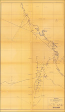
Italian Imperial Aspirations in East Africa, as Understood in Fascist Italy.
Detailed, color-printed wall map of Italian East Africa, published by the Instituto Geografico Militare-Firenze in 1936, the year the colony was established.
In addition to Italian East Africa, the map shows "Somalia Britanca." (now Somaliland), "Somalia. Frse." (now Djibouti).
The map image is surrounded by five portraits: Benito Mussolini, Vittorio Emanuele III, Rudolfo Graziani, Pietro Badoglio, and Emilio de Bono. The multi-part key illustrates a host of other information.
Italian East Africa
Italian East Africa was an Italian colony established in 1936, consolidating preexisting Italian territories in East Africa with the newly-conquered Empire of Ethiopia.
As is shown on the map, the Italians quickly assumed the imperial trappings of the Empire of Ethiopia; here Vittorio Emanuele III is called "King of Italy and Emperor of Ethiopia" and Pietro Badoglio is "Duke of Addis Abeba". These titles were not recognized outside of Italy, Nazi Germany, and Japan.
The map illustrates the subsidiary divisions of the colony: Somalia, Arrar, Galla-Sidamo, Addis-Abeba, Amhara, and Eritrea.
The colony would be expanded in 1940 with the conquest of French Somalia and British Somalia. In 1942, British and South African forces had captured most of the colony, though an Italian guerrilla campaign continued into the next year.
![[Kingdom of Persia] Regno di Persia con le notitie Provincie Antiche, che piu probabilmente corrispondono alle Divisioni moderne d'esso Regno . . . 1679](https://storage.googleapis.com/raremaps/img/small/75921.jpg)